Category:1914 maps
Jump to navigation
Jump to search
| ← · 1910 · 1911 · 1912 · 1913 · 1914 · 1915 · 1916 · 1917 · 1918 · 1919 · → |
Deutsch: Karten mit Bezug zum Jahr 1914
English: Maps related to the year 1914
Español: Mapas relativos al año 1914
Français : Cartes concernant l’an 1914
Русский: Карты 1914 года
Subcategories
This category has the following 9 subcategories, out of 9 total.
Media in category "1914 maps"
The following 176 files are in this category, out of 176 total.
-

-
-

-

-

-
 (Map of World War I battle positions in the Bruges region, Belgium). LOC 80691199.jpg 14,562 × 8,026; 15.63 MB
-
 (Map of World War I battle positions in the Bruges region, Belgium). LOC 80691199.tif 14,562 × 8,026; 334.38 MB
-
 154-155BriarcliffManor1.jpg 1,536 × 1,079; 409 KB
-
 BAEDEKER(1914) p079 Poland, Warsaw (I).jpg 3,176 × 2,428; 1.3 MB
-
 BAEDEKER(1914) p119 Pskov.jpg 2,052 × 2,832; 1.92 MB
-
 BAEDEKER(1914) p127 Latvia, (Jelgava) Mitau.jpg 2,394 × 2,044; 558 KB
-
 BAEDEKER(1914) p127 Latvia, (Liepāja) Libau.jpg 2,382 × 1,524; 490 KB
-
 BAEDEKER(1914) p299 Pavlovsk.jpg 3,616 × 2,378; 1.16 MB
-
 BAEDEKER(1914) p329 Finland, Imatra, Vattenfall.jpg 1,008 × 948; 182 KB
-
 BAEDEKER(1914) p356 Finland, Hangö.jpg 2,072 × 892; 714 KB
-
 BAEDEKER(1914) p552 Odessa.jpg 3,840 × 2,482; 1.24 MB
-
 BAEDEKER(1914) p553 Odessa.jpg 3,856 × 2,505; 1.16 MB
-
 1914 Bay State Street Railway map.png 3,500 × 2,862; 11.76 MB
-
 1914 BERy ownership map.jpg 4,840 × 6,694; 21.89 MB
-
 1914 BERy track map.png 3,500 × 4,871; 31.22 MB
-
 1914 Boston and north street railway map.png 3,500 × 2,897; 16.42 MB
-
 1914 Brockton & Plymouth Street Railway map.png 1,666 × 2,500; 5.9 MB
-
 1914 BTC subway map.png 3,500 × 3,092; 18.78 MB
-
 1914 Plan Khersonesa-Tavrycheskogo (Bumberg).jpg 13,336 × 6,355; 10.35 MB
-
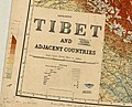
 1914 Survey of India map of Tibet and Adjacent Countries.jpg 15,788 × 10,680; 9.8 MB
-
 1914 Б-Охт.jpg 1,897 × 889; 799 KB
-
 1914 М-Охт.jpg 1,905 × 972; 867 KB
-
 1Fi108 Plan de Rennes 1914.jpg 9,979 × 7,926; 6.58 MB
-
 Aero view of Manchester, Connecticut 1914. LOC 75693150.jpg 15,546 × 10,989; 33.65 MB
-
 Aero view of Manchester, Connecticut 1914. LOC 75693150.tif 15,546 × 10,989; 488.76 MB
-
 Aero view of Southington, Connecticut 1914. LOC 75693163.jpg 11,712 × 8,752; 18.19 MB
-
 Aero view of Southington, Connecticut 1914. LOC 75693163.tif 11,712 × 8,752; 293.26 MB
-

-

-
 Amsterdam, Oostelijk Havengebied (1914).jpg 1,200 × 867; 456 KB
-

-
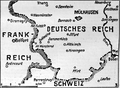
 Armenien 1914.png 2,360 × 1,650; 1,002 KB
-
 Batumi. city map (Wagner & Debes, Leipzig 1914).jpg 500 × 376; 158 KB
-
 Bird's-eye view of Fort Worth, Texas. LOC 75696595.jpg 3,101 × 2,740; 1.01 MB
-
 Bird's-eye view of Fort Worth, Texas. LOC 75696595.tif 3,101 × 2,740; 24.31 MB
-
 Borjomi, city map with environs map (Wagner & Debes, Leipzig 1914).jpg 460 × 500; 171 KB
-
 Brainerd, "City of Mines." LOC 75694636.jpg 8,512 × 6,400; 16.06 MB
-
 Brainerd, "City of Mines." LOC 75694636.tif 8,512 × 6,400; 155.86 MB
-
 Bukarest - 44-44.jpg 3,633 × 4,971; 2.86 MB
-
 Buriaky 1914 Map.jpg 546 × 447; 96 KB
-
 Camargue baedeker.png 250 × 295; 55 KB
-
 Ceiling above the First Class Dining Saloon on the 'Aquitania' (1914) RMG G10838.tiff 2,000 × 1,657; 9.48 MB
-
 Central Seattle. 1914.jpg 476 × 381; 106 KB
-
 Decorative painting in the Grand Entrance on the 'Aquitania' (1914) RMG G10835.tiff 1,673 × 2,000; 9.57 MB
-

-

-
 Detail, KANGCHENJUNGA MAP by JACOT-GUILLARMOD, 1914 (cropped).jpg 2,703 × 1,392; 706 KB
-
 Deutsche Kriegszeitung (1914) 01 02 2.png 542 × 399; 306 KB
-
 Deutsche Kriegszeitung (1914) 01 02 3.png 542 × 397; 239 KB
-
 Deutsche Kriegszeitung (1914) 01 04 1.png 268 × 266; 79 KB
-
 Distribution of Farming, Lumbering, and Mining Industries in Washington, 1914.jpg 1,777 × 1,187; 1.05 MB
-
 Egypte - Canal de Suez - Arabie - Golfe Persique (FL35468075 2367060).jpg 17,200 × 13,246; 318.99 MB
-
 First Class bath and toilet suite on the 'Aquitania' (1914) RMG G10830.tiff 2,000 × 1,675; 9.58 MB
-
 First Class Dining Saloon on the 'Aquitania' (1914) RMG G10836.tiff 2,000 × 1,653; 9.46 MB
-
 First Class Music and Recreation Room on the 'Highland Brae' (1910) RMG G10942.tiff 2,000 × 1,660; 9.5 MB
-
 First Class Smoking Room on the 'Aquitania' (1914) RMG G10883.tiff 6,265 × 7,674; 137.55 MB
-
 First Class stateroom on the 'Aquitania' (1914) RMG G10828.tiff 1,645 × 2,000; 9.41 MB
-
 Geological magazine (1914) (14577984658).jpg 1,895 × 1,380; 346 KB
-
 Gids voor Groningen1.jpg 4,391 × 6,236; 3.3 MB
-
 Grand entrance on the 'Aquitania' (1914) RMG G10824.tiff 2,000 × 1,640; 9.38 MB
-
 Haim Goldberg, מאפע פון דער אייראפעאישער קריעג 01 (FL155882407 3778443).jpg 3,524 × 4,530; 17.25 MB
-
 Haim Goldberg, מאפע פון דער אייראפעאישער קריעג 02 (FL155882413 3778443).jpg 3,511 × 4,518; 17 MB
-

-

-
 Ivanovo (Kiryanov) 1914.jpg 3,952 × 4,392; 12.22 MB
-
 Jankovich-barlang 001 térkép 1917.jpg 1,702 × 2,404; 523 KB
-

-
 KANGCHENJUNGA MAP by JACOT-GUILLARMOD, 1914 (cropped).jpg 2,405 × 1,555; 727 KB
-
 KANGCHENJUNGA MAP by JACOT-GUILLARMOD, 1914.jpg 3,060 × 2,305; 1.06 MB
-
 Karta OVD sl. Gol. x. Tuz 1914.jpg 921 × 552; 161 KB
-
 Krystallpalast Leipzig 1914.jpg 1,378 × 987; 1.51 MB
-
 Ludwig Ravenstein - Ravensteins Kriegskarte 17.jpg 3,750 × 2,769; 10.44 MB
-
 Map - Europe in Summer 1914.png 3,760 × 2,324; 213 KB
-
 Map of Ford's Island, Oahu, H. T. - NARA - 77-WDMC Hawaii-82.jpg 9,618 × 8,167; 31.35 MB
-
 Map of Ford's Island, Oahu, H. T. - NARA - 77-WDMC Hawaii-82.TIF 9,618 × 8,167; 224.75 MB
-
 Map of Oz.png 717 × 500; 186 KB
-

-

-
 Map of the countries near to the land of Oz (26938965685).jpg 2,000 × 1,386; 3.1 MB
-
 Map of the National Zoological Park, Washington, D.C. LOC 88690999.jpg 7,283 × 6,644; 5.37 MB
-
 Map of the National Zoological Park, Washington, D.C. LOC 88690999.tif 7,283 × 6,644; 138.44 MB
-

-

-
 Map-of-Oz.jpg 717 × 500; 126 KB
-

-
-
 Mapa da Madeira, 1914.jpg 484 × 690; 65 KB
-
 Milano TouringClubItaliano 1914.jpg 2,206 × 2,551; 2.46 MB
-
 Nauru map 1914 42000.png 1,901 × 1,900; 2.19 MB
-
 New Market, Va., battlefield May 15, 1864 LOC 99448860.jpg 5,208 × 5,133; 3.03 MB
-
 New Market, Va., battlefield May 15, 1864 LOC 99448860.tif 5,208 × 5,133; 76.48 MB
-
 New Providence 1914 map.jpg 1,300 × 925; 245 KB
-
 Novgorod 1701-1745.png 2,128 × 1,513; 1.03 MB
-
 Ordnance Survey, Abda (FL35468093 2367583).jpg 13,339 × 15,897; 289.93 MB
-
 Ordnance Survey, Beersheba (FL35468211 2367598).jpg 13,657 × 15,926; 276.02 MB
-
 Ordnance Survey, Gebel Harun +Index 01 (FL35468169 2367582).jpg 15,212 × 16,982; 322.57 MB
-
 Ordnance Survey, Gebel Harun +Index 02-index (FL35468172 2367582).jpg 7,191 × 5,064; 45.46 MB
-
 Ordnance Survey, Wadi el Jeib (FL35468145 2367580).jpg 16,341 × 15,372; 304.09 MB
-
 Ordnance Survey, Wadi Fai (FL35468319 2367599).jpg 15,121 × 16,201; 315.7 MB
-
 Ottoman conquests.jpg 4,792 × 3,384; 6.65 MB
-
 Ottoman revenge map after Balkan wars.jpeg 4,384 × 2,885; 15 MB
-
 Oz and surrounding countries.png 710 × 500; 189 KB
-
 Oz-and-surrounding-countrie.jpg 1,511 × 1,056; 519 KB
-
 P507 Map of Siberia, showing Dr Nansen's routes, outward and homeward.jpg 3,402 × 2,393; 2.97 MB
-

-
 P511 Map of Eastern Siberia, showing Dr Nansen's routes.jpg 2,818 × 2,016; 2.07 MB
-
 Pictorial map of Washington LOC 87693433.jpg 14,677 × 7,841; 17.06 MB
-
 Pictorial map of Washington LOC 87693433.tif 14,677 × 7,841; 329.25 MB
-
 Pictorial map of Washington, D.C. LOC 87693425.tif 2,916 × 5,252; 43.82 MB
-
 Plan Weinsberg 1914 von Karl Burkhardt AM.png 2,868 × 2,012; 3.33 MB
-
 Plan Weinsberg 1914 von Karl Burkhardt.png 2,868 × 2,012; 4.14 MB
-
 Plano de Ostende, Argentina (1914).jpg 2,528 × 4,609; 5.14 MB
-
 Planta da Villa Aricanduva - 1, Acervo do Museu Paulista da USP.jpg 7,216 × 5,412; 16.58 MB
-
 Planta dos Campos do Copouva, Acervo do Museu Paulista da USP.jpg 7,216 × 5,412; 19.51 MB
-

-
 Pola 1914.jpg 2,448 × 3,364; 7.26 MB
-
 Queens V. 10, Plate No. 50 (Map bounded by Polk Ave., 43rd St., Roosevelt Ave., 40th St.) NYPL1957008.tiff 5,409 × 7,211, 2 pages; 111.65 MB
-
 Queens V. 3, Plate No. 8 (Map bounded by De Bevoise Ave., Waters Ave., Clark Ave., Halle Ave.) NYPL1956379.tiff 5,412 × 7,216, 2 pages; 111.79 MB
-
 Rembrandt Suite on the 'Aquitania' (1914) RMG G10829.tiff 2,000 × 1,645; 9.41 MB
-
-

-
 Scheme of historical expansion of the Moscow Kremlin (1914).png 2,409 × 2,736; 7.85 MB
-
 Section 5 of Freeport NYPL1633839.tiff 7,230 × 4,468; 92.42 MB
-
 Serving window in the First Class Grill Room on the 'Aquitania' (1914) RMG G10929.tiff 2,000 × 1,692; 9.68 MB
-
 Simla Accord Treaty 1914 Map2.jpg 2,424 × 1,872; 1.42 MB
-
 Spaniards in Argentina (1914).png 568 × 937; 54 KB
-
 Spezialkarte der Österreichisch-ungarischen Monarchie - Adelsberg 1914.jpg 13,247 × 10,127; 26.58 MB
-
 Spezialkarte der Österreichisch-ungarischen Monarchie - Flitsch 1914.jpg 13,742 × 10,320; 34.07 MB
-
 Spezialkarte der Österreichisch-ungarischen Monarchie - Gurkfeld, Rann und Samobor 1914.jpg 13,685 × 10,316; 31.4 MB
-
 Spezialkarte der Österreichisch-ungarischen Monarchie - Görz und Gradisca 1914.jpg 13,600 × 10,240; 27.46 MB
-
 Spezialkarte der Österreichisch-ungarischen Monarchie - Karlovac und Vojnić 1914.jpg 13,276 × 10,210; 30.74 MB
-
 Spezialkarte der Österreichisch-ungarischen Monarchie - Laas und Čabar 1914.jpg 13,788 × 10,346; 31.72 MB
-
 Spezialkarte der Österreichisch-ungarischen Monarchie - Laibach 1914.jpg 13,744 × 10,323; 27.95 MB
-
 Spezialkarte der Österreichisch-ungarischen Monarchie - Marburg 1914.jpg 13,779 × 10,331; 29.72 MB
-
 Spezialkarte der Österreichisch-ungarischen Monarchie - Pettau und Vinica 1914.jpg 13,815 × 10,310; 28.88 MB
-
 Spezialkarte der Österreichisch-ungarischen Monarchie - Pragerhof und Wind. Feistrit 1914.jpg 13,798 × 10,259; 28.95 MB
-
 Spezialkarte der Österreichisch-ungarischen Monarchie - Radkersburg und Luttenberg 1914.jpg 13,788 × 10,258; 25.86 MB
-
 Spezialkarte der Österreichisch-ungarischen Monarchie - Radmannsdorf 1914.jpg 13,759 × 10,340; 31.24 MB
-
 Spezialkarte der Österreichisch-ungarischen Monarchie - Rohitsch und Drachenburg 1914.jpg 13,730 × 10,269; 30.99 MB
-
 Spezialkarte der Österreichisch-ungarischen Monarchie - Rudolfswerth 1914.jpg 13,764 × 10,359; 31.85 MB
-
 Spezialkarte der Österreichisch-ungarischen Monarchie - Sesana und St. Peter 1914.jpg 13,742 × 10,368; 29.79 MB
-
 Spezialkarte der Österreichisch-ungarischen Monarchie - Tolmein 1914.jpg 13,745 × 10,263; 31.02 MB
-
 Spezialkarte der Österreichisch-ungarischen Monarchie - Triest 1914.jpg 13,030 × 10,024; 22.59 MB
-
 Spezialkarte der Österreichisch-ungarischen Monarchie - Weixelburg und Zirknitz 1914.jpg 13,779 × 10,333; 29.45 MB
-
 Spitzbergen Karte von Carl Schmidt 1914.jpg 1,865 × 2,187; 1.64 MB
-
 Submarines, mines and torpedoes in the war (1914) (14576731388).jpg 2,984 × 3,452; 2.08 MB
-
 Survey of Egypt, Map of Cairo (FL33127497 2370085).jpg 8,371 × 11,808; 143.52 MB
-

-

-

-

-

-
 The problem of greater New York and its solution (1914) (14581917969).jpg 2,162 × 3,608; 534 KB
-
 The problem of greater New York and its solution (1914) (14766203014).jpg 3,600 × 2,650; 861 KB
-
 The Times history of the war (1914) (14578037907).jpg 2,066 × 1,508; 333 KB
-
 The United States in 1790 ; The United States in 1900. LOC 2018590088.tif 3,911 × 2,579; 28.86 MB
-
 Tbilisi city map (Wagner & Debes, Leipzig 1914).jpg 500 × 373; 175 KB
-
 Tiflis BaedekerMapI-1914.jpg 1,296 × 1,945; 1.3 MB
-
 Tiflis BaedekerMapII-1914.jpg 1,296 × 1,951; 1.55 MB
-
 Tilted, 1914 Survey of India map of Tibet and Adjacent Countries (cropped).jpg 4,860 × 3,915; 1.2 MB
-
 Twin Cities Rapid Transit Route Map 1914.jpg 1,498 × 962; 584 KB
-

-
 Usmanskiy-uezd-1914.jpg 673 × 458; 139 KB
-
 Valley Stream NYPL1633784.tiff 5,428 × 6,820; 105.91 MB
-
 Valley Stream, Lynbrook, Rockville Centre, Woodmere, Etc. NYPL1633777.tiff 7,230 × 4,468; 92.42 MB
-
 Virginia LOC 95682743.jpg 9,635 × 4,716; 6.31 MB
-
 Virginia LOC 95682743.tif 9,635 × 4,716; 130 MB
-
 Washington State Map - 1914.jpg 3,350 × 2,443; 3.62 MB
-
 Western Europe in the time of Charles V (1525).jpg 2,212 × 2,829; 1.9 MB
-
 Yungnulgra County parish map 1914.jpg 5,000 × 9,498; 19.88 MB
-

tod-Bod%3DTibet%22_%22High-Bod%22_English_and_Tibetan_hand-written_notes,_from-_1914_Survey_of_India_map_of_Tibet_and_Adjacent_Countries_(cropped).jpg)
.jpg)
_detail,_from-_1914_Survey_of_India_map_of_Tibet_and_Adjacent_Countries_(cropped)_(cropped)_(cropped).jpg)
,_from-_1914_Survey_of_India_map_of_Tibet_and_Adjacent_Countries_(cropped)_(cropped).jpg)
._LOC_80691199.jpg)

_p079_Poland,_Warsaw_(I).jpg)
_p119_Pskov.jpg)
_p127_Latvia,_(Jelgava)_Mitau.jpg)
_p127_Latvia,_(Liep%C4%81ja)_Libau.jpg)
_p299_Pavlovsk.jpg)
_p329_Finland,_Imatra,_Vattenfall.jpg)
_p356_Finland,_Hang%C3%B6.jpg)
_p552_Odessa.jpg)
_p553_Odessa.jpg)


.jpg)


_-_1_(1),_Acervo_do_Museu_Paulista_da_USP.jpg)
_-_1_(2),_Acervo_do_Museu_Paulista_da_USP.jpg)
.jpg)
_(18738457344).jpg)

.jpg)

.jpg)


.jpg)
_01_02_2.png)
_01_02_3.png)
_01_04_1.png)

.jpg)
_(14577984658).jpg)

.jpg)
.jpg)
_2022-06-12_Mattes.jpg)
_2022-06-12_Mattes.jpg)
_1914.jpg)

_36_1_Lageplan_der_Kreis-Industriebahn.jpg)
.jpg)


.jpg)


,_Acervo_do_Museu_Paulista_da_USP.jpg)
,_Acervo_do_Museu_Paulista_da_USP.jpg)


.jpg)
.jpg)
.jpg)
.jpg)
.jpg)
.jpg)


.jpg)


_(14578754107).jpg)
.png)

.png)


_(14576731388).jpg)
.jpg)

_(14581917969).jpg)
_(14766203014).jpg)
_(14578037907).jpg)
.jpg)


.jpg)


.jpg)


,_from-_1914_Survey_of_India_map_of_Tibet_and_Adjacent_Countries_(cropped).jpg)