Category:1911 maps of Ohio
Jump to navigation
Jump to search
States of the United States: California · Connecticut · Delaware · Idaho · Illinois · Iowa · Kansas · Louisiana · Massachusetts · Michigan · Minnesota · Missouri · New York · Ohio · Oklahoma · Pennsylvania · Rhode Island · South Carolina · South Dakota · Texas · Utah · Virginia · West Virginia · Wisconsin · Wyoming – Washington, D.C.
| ← 1910 1911 1912 1913 |
Media in category "1911 maps of Ohio"
The following 6 files are in this category, out of 6 total.
-
 EB11 Ohio.jpg 4,443 × 3,161; 4.47 MB
-
 Highway Map of Defiance County, Ohio - NARA - 131043897.jpg 9,193 × 6,776; 7.99 MB
-
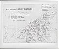 Map of Cleveland Library Districts in 1911.jpg 5,277 × 4,420; 1.92 MB
-

-

-
 The Commercial and financial chronicle (1911) (14781729662).jpg 4,336 × 2,656; 2.55 MB


_(14767100002).jpg)
_(14781729662).jpg)