
Category:1900s maps of West Virginia
States of the United States: Alabama · Alaska · Arizona · Arkansas · California · Colorado · Connecticut · Delaware · Florida · Georgia · Hawaii · Idaho · Illinois · Indiana · Iowa · Kansas · Kentucky · Louisiana · Maine · Maryland · Massachusetts · Michigan · Minnesota · Mississippi · Missouri · Montana · Nebraska · Nevada · New Hampshire · New Jersey · New Mexico · New York · North Carolina · North Dakota · Ohio · Oklahoma · Oregon · Pennsylvania · Rhode Island · South Carolina · South Dakota · Tennessee · Texas · Utah · Vermont · Virginia · Washington · West Virginia · Wisconsin · Wyoming – Washington, D.C.
Puerto Rico
Puerto Rico
Media in category "1900s maps of West Virginia"
The following 6 files are in this category, out of 6 total.
-
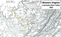 Western Virginia 1862.png 1,066 × 651; 1.39 MB
-

-
 Map of West Virginia showing railroads and county products (11842969584).jpg 2,000 × 1,442; 2.46 MB
-
 NIE 1905 Virginia and West Virginia.jpg 2,074 × 1,566; 1.14 MB
-

-


.jpg)

.jpg)
