Category:1900s maps of Montana
Jump to navigation
Jump to search
States of the United States: Alabama · Alaska · Arizona · Arkansas · California · Colorado · Connecticut · Delaware · Florida · Georgia · Hawaii · Idaho · Illinois · Indiana · Iowa · Kansas · Kentucky · Louisiana · Maine · Maryland · Massachusetts · Michigan · Minnesota · Mississippi · Missouri · Montana · Nebraska · Nevada · New Hampshire · New Jersey · New Mexico · New York · North Carolina · North Dakota · Ohio · Oklahoma · Oregon · Pennsylvania · Rhode Island · South Carolina · South Dakota · Tennessee · Texas · Utah · Vermont · Virginia · Washington · West Virginia · Wisconsin · Wyoming – Washington, D.C.
Puerto Rico
Puerto Rico
Media in category "1900s maps of Montana"
The following 5 files are in this category, out of 5 total.
-
 The new international encyclopaedia (1905) (14589744548).jpg 1,966 × 1,566; 627 KB
-
 Custer Battlefield 1908 (top).jpg 4,032 × 2,115; 2.8 MB
-
 Montana Presidential Election Results 1900.svg 810 × 473; 45 KB
-
 Montana Presidential Election Results 1908.svg 810 × 473; 38 KB
-
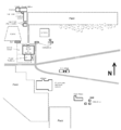 St Peters Mission layout - near Cascade Montana - c 1907.png 1,005 × 1,082; 71 KB
_(14589744548).jpg)
.jpg)


