Category:1900s maps of New Hampshire
Jump to navigation
Jump to search
States of the United States: Alabama · Alaska · Arizona · Arkansas · California · Colorado · Connecticut · Delaware · Florida · Georgia · Hawaii · Idaho · Illinois · Indiana · Iowa · Kansas · Kentucky · Louisiana · Maine · Maryland · Massachusetts · Michigan · Minnesota · Mississippi · Missouri · Montana · Nebraska · Nevada · New Hampshire · New Jersey · New Mexico · New York · North Carolina · North Dakota · Ohio · Oklahoma · Oregon · Pennsylvania · Rhode Island · South Carolina · South Dakota · Tennessee · Texas · Utah · Vermont · Virginia · Washington · West Virginia · Wisconsin · Wyoming – Washington, D.C.
Puerto Rico
Puerto Rico
Media in category "1900s maps of New Hampshire"
The following 11 files are in this category, out of 11 total.
-
 New Hampshire 1660.jpg 1,554 × 1,235; 687 KB
-

-
-
 NIE 1905 New Hampshire - and Vermont.jpg 1,699 × 2,043; 1.76 MB
-
 Birds-eye view from summit of Mt. Washington, White Mountains, New-Hampshire LOC 85693138.jpg 7,889 × 8,289; 10.67 MB
-
 Birds-eye view from summit of Mt. Washington, White Mountains, New-Hampshire LOC 85693138.tif 7,889 × 8,289; 187.09 MB
-
 Birds-eye view from summit of Mt. Washington, White Mountains, New-Hampshire LOC 85693139.jpg 7,915 × 8,322; 10.62 MB
-
 Birds-eye view from summit of Mt. Washington, White Mountains, New-Hampshire LOC 85693139.tif 7,915 × 8,322; 188.45 MB
-
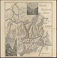
 Bulletin (1905) (14763295752).jpg 1,836 × 3,170; 665 KB
-
 Bulletin (1905) (14763627335).jpg 1,870 × 3,212; 844 KB
-
 New Hampshire Map 1904 American Commonwealth's, low resolution.jpg 343 × 605; 125 KB

.jpg)


_(14763295752).jpg)
_(14763627335).jpg)
