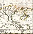
Category:18th-century maps of Vietnam
Appearance
Subcategories
This category has the following 3 subcategories, out of 3 total.
1
C
T
Media in category "18th-century maps of Vietnam"
The following 19 files are in this category, out of 19 total.
-
AMH-7931-KB Map of the coast of Tonquin and Cochinchina.jpg 1,727 × 2,400; 579 KB
-
Da Qing fen sheng yu tu LOC 2002626726-1.jpg 5,280 × 4,534; 2.43 MB
-
Da Qing fen sheng yu tu LOC 2002626726-1.tif 5,280 × 4,534; 68.49 MB
-
Vietnam 1760.jpg 2,290 × 2,790; 2.5 MB
-
1771 Bonne Map of Tonkin and Cochinchina (Vietnam).jpg 1,154 × 1,189; 436 KB
-
Plan d'une partie des côtes de la Cochinchine 1787 - Le Floch de La Carrière.jpg 5,353 × 3,626; 2.6 MB
-
A new chart of the China, with its several entrances.jpg 7,728 × 11,402; 11.95 MB
-
ParacelBank1791.jpg 1,883 × 3,050; 866 KB


