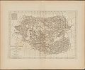
Category:18th-century maps of Uzbekistan
Appearance
Media in category "18th-century maps of Uzbekistan"
The following 8 files are in this category, out of 8 total.
-
Horograficheskaya kniga sibiri-122-138 page-0001.jpg 2,500 × 1,750; 2.26 MB
-
Horograficheskaya kniga sibiri-122-138 page-0017.jpg 2,500 × 1,737; 2.47 MB
-
Nova maris Caspii et regionis Usbeck cum provincijs adjacentibus vera delineatio.pdf 4,372 × 3,241; 2.05 MB
-
Nova Maris Caspii Et Regionis Usbeck Cum Provincis Adjecentibus vera Delineatio.jpg 14,453 × 12,247; 36.8 MB
-
A map of independent Tartary, containing the countries of the Kalmuks and Uzbecks, with the Tibet (NYPL b13919861-5207420).tiff 10,326 × 7,758, 2 pages; 229.46 MB


