Category:18th-century maps of Korea
Jump to navigation
Jump to search
Subcategories
This category has the following 9 subcategories, out of 9 total.
1
- (Yŏjido) (26 F)
- Yŏji yoram (54 F)
- Carte de la Tartarie (1706) (10 F)
- (Tongguk chido) (22 F)
- Sŏn yŏkto (21 F)
- Tongguk chido (37 F)
- Tongguk yŏjido (51 F)
K
Media in category "18th-century maps of Korea"
The following 91 files are in this category, out of 91 total.
-
Chunha daechong il ram jido early 1700.jpg 800 × 665; 145 KB
-
Delisle Asie3.png 874 × 890; 1.91 MB
-
Jan Janssonius - Japan.jpg 6,726 × 5,561; 8.04 MB
-
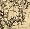
Mer Orientale 1700.jpg 626 × 608; 379 KB
-
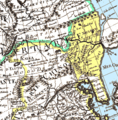
Delisle Asie3b.png 874 × 890; 204 KB
-
AMH-6662-KB Map of China.jpg 1,940 × 2,400; 1.06 MB
-
Map-of-Japan-1707-William-Adams-Visits-Shogun.png 3,203 × 2,197; 10.08 MB
-
Carte huilée du royaume de Corée fournie aux jésuites par les chinois - btv1b59627255.jpg 6,648 × 9,592; 8.26 MB
-
B26055931I - Carte des Indes, de la Chine des Iles de Sumatra, Java.jpg 5,860 × 6,124; 11.21 MB
-
Royaume de Corée - d'Anville - btv1b5963117v.jpg 4,424 × 6,448; 4.65 MB
-
Der Jesuiten-Atlas der Kanghsi-Zeit - China und die Aussenlaender LOC 74650033-20.jpg 7,201 × 9,634; 6.93 MB
-
Der Jesuiten-Atlas der Kanghsi-Zeit - China und die Aussenlaender LOC 74650033-20.tif 7,201 × 9,634; 198.48 MB
-
Royaume de Corée - (d'Anville) - btv1b59631188.jpg 2,072 × 3,104; 1,011 KB
-
AMH-8129-KB Map of part of Japan, China and Formosa.jpg 2,400 × 2,077; 680 KB
-
Cartes particulières de la Tartarie chinoise - D'Anville - btv1b5963110z (02 of 12).jpg 5,808 × 3,872; 3.13 MB
-
Royaume de Corée - (d'Anville) ; Delahaye fils sculpsit - btv1b5963116f.jpg 4,408 × 6,448; 4.55 MB
-
Anville Nouvel atlas de la Chine - Page56 Tartarie.jpg 2,500 × 1,610; 2.86 MB
-
Anville Nouvel atlas de la Chine - Page60 tartarie 2 nimgouta.jpg 4,180 × 2,560; 3.21 MB
-
Anville Nouvel atlas de la Chine - Page84 Coree.jpg 3,723 × 5,249; 5.04 MB
-
CEM-44-La-Chine-la-Tartarie-Chinoise-et-le-Thibet-1734-Liaodong-2755.jpg 2,048 × 1,536; 1.57 MB
-
Royaume de Corée - (d'Anville) ; C. Kondet scrip., fecit. - btv1b59631151.jpg 4,432 × 6,448; 5.34 MB
-
Royaume de Corée - (d'Anville) ; Delahaye fils sculpsit - btv1b530274374.jpg 5,159 × 6,767; 5.26 MB
-
Korease.jpg 800 × 600; 114 KB
-
AMH-8182-KB Map of China.jpg 2,400 × 2,104; 1.37 MB
-
Map Japan 1746.JPG 409 × 295; 20 KB
-
Map of Korea.jpg 800 × 600; 131 KB
-
L'Empire de la Chine pour servir a L'histoire générale des voyages LOC 2006629393.jpg 6,810 × 5,064; 6.37 MB
-
L'Empire de la Chine pour servir a L'histoire générale des voyages LOC 2006629393.tif 6,810 × 5,064; 98.67 MB
-
1749 map Chinese Tartary by Tobias Mayer.jpg 19,690 × 12,721; 45.11 MB
-
Joseon at its end.jpg 586 × 616; 119 KB
-
Tatariae Sinensis mappa geographica 1749 24374665.jpg 13,080 × 7,036; 22.5 MB
-
AMH-7966-KB Map of China and Korea.jpg 2,400 × 2,241; 1.29 MB
-
KKR-20 La CHINE avec la Korée et les Parties de la Tartarie.jpg 3,148 × 2,584; 1.1 MB
-
Carte de la Corée - Dheulan Sculp. - btv1b5963114m.jpg 2,928 × 4,392; 1.92 MB
-
Carte de la Corée - par J.-B. d'Anville - btv1b8468520p.jpg 3,168 × 5,088; 2.63 MB
-
Huang chao zhi sheng yu di quan tu - Lu ying sheng - btv1b52505943g.jpg 16,210 × 9,584; 23.59 MB
-
프랑스의 독도지도1 copy.gif 361 × 461; 164 KB
-
Carte-des-isles-du-japon-terre-de-jesso-et-pays-voisoins-d-bellin.jpg 1,799 × 1,300; 2.61 MB
-
Da Qing fen sheng yu tu LOC 2002626726-1.jpg 5,280 × 4,534; 2.43 MB
-
Da Qing fen sheng yu tu LOC 2002626726-1.tif 5,280 × 4,534; 68.49 MB
-
Fengma Island 1754.jpg 1,105 × 1,082; 154 KB
-
L'Asie divisée en tous ses Etats 2.jpg 1,089 × 1,515; 376 KB
-
A new & accurate map of China LOC 2006629424.tif 7,154 × 5,799; 118.69 MB
-
A new & accurate map of China LOC 2006629424.jpg 7,154 × 5,799; 7.9 MB
-
1770 Bonne Map of China, Korea, Japan and Formosa - Geographicus - China-bonne-1770.jpg 4,000 × 2,787; 3.09 MB
-
Carte des Isles du Japon - OTM- HB-KZL I 2 A 9 (31a).jpg 3,436 × 2,612; 3.2 MB
-
Histoire des deux Indes-Atlas-d26-C08-Chine.png 3,147 × 2,329; 2.47 MB
-
1784 Zatta Map of Chinese Tartary and Korea.jpg 600 × 459; 91 KB
-
A map of Chinese Tartary, with Corea (NYPL b13919861-5207424).jpg 8,013 × 6,638; 44.64 MB
-
A map of Chinese Tartary, with Corea (NYPL b13919861-5207424).tiff 10,326 × 7,758, 2 pages; 229.46 MB
-
China, divided into its great provinces, and the Isles of Japan (NYPL b13919861-5207423).jpg 8,045 × 6,648; 44.32 MB
-
China, divided into its great provinces, and the Isles of Japan (NYPL b13919861-5207423).tiff 6,439 × 4,519; 83.46 MB
-
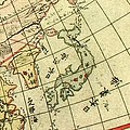
Chikyu zenzu.JPG 326 × 326; 70 KB
-
Erdglobus aus Salem img04.jpg 4,288 × 2,848; 6.33 MB
-
SeaEst in Koeea18c.jpg 730 × 564; 283 KB
-
Map China c1798.jpg 940 × 894; 297 KB
-
La-Perouse-Chart-of-Discoveries.jpg 3,216 × 4,144; 1.39 MB
-
Illustrated general route map of three countries (14590511136).jpg 2,500 × 1,764; 1.2 MB
-
Dongguk daejido late 1700.jpg 700 × 1,293; 459 KB
-
Haedongjido Namhansanseong.jpg 950 × 694; 176 KB
-
Imperii Sinarum nova descriptio - btv1b84415340.jpg 10,618 × 7,800; 10.3 MB
-
Josun jundo 1757 jung sang gi.jpg 700 × 1,376; 358 KB
-
Josun jundo jido late 1700.jpg 700 × 1,267; 394 KB
-
Koreane.jpg 800 × 600; 137 KB
-
Mapa de Hanyang de 1760.jpg 940 × 1,235; 280 KB
-
Rigobert-Bonne-Atlas-de-toutes-les-parties-connues-du-globe-terrestre MG 9996.tif 3,536 × 5,280; 53.45 MB
-
The Complete Map of Sim-bu (Ganghwa-bu).jpg 1,600 × 2,300; 759 KB
-
The Map of the Walled City of the Sim-bu Government.jpg 1,600 × 2,300; 574 KB
-
한양도.jpg 1,389 × 962; 1.82 MB


