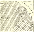
Category:1880s maps of San Francisco
Jump to navigation
Jump to search
Subcategories
This category has the following 3 subcategories, out of 3 total.
Media in category "1880s maps of San Francisco"
The following 5 files are in this category, out of 5 total.
-
EB9 San Francisco - map of environs.jpg 857 × 1,185; 310 KB
-
EB9 San Francisco - map of north-eastern part.jpg 1,321 × 1,254; 635 KB
-
Karte San Francisco MKL1888.png 745 × 492; 127 KB
-
Official map of "Chinatown" in San Francisco LOC 2012593519.jpg 9,970 × 6,682; 7.64 MB
-
Official map of "Chinatown" in San Francisco LOC 2012593519.tif 9,970 × 6,682; 190.6 MB


