Category:19th-century maps of San Francisco
Jump to navigation
Jump to search
Subcategories
This category has the following 6 subcategories, out of 6 total.
- 1850s maps of San Francisco (20 F)
- 1860s maps of San Francisco (9 F)
1
- 1873 maps of San Francisco (2 F)
Media in category "19th-century maps of San Francisco"
The following 8 files are in this category, out of 8 total.
-
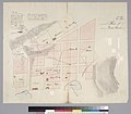 1839 Plan of Yerba Buena (Jean Jacques Vioget).jpg 2,400 × 2,107; 727 KB
-
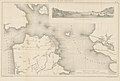
 View of San Francisco 1846-7.jpg 6,509 × 5,999; 15.86 MB
-
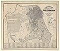
 1872 Mitchell Map of California w- San Francisco Inset - Geographicus - CA-mitchell-1872.jpg 3,402 × 5,000; 5.53 MB
-

-

-
-
-

.jpg)


%27_(11253567516).jpg)

%27_(11104466165).jpg)

