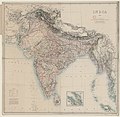
Category:1870s maps of India
Jump to navigation
Jump to search
Subcategories
This category has the following 11 subcategories, out of 11 total.
- 1870 maps of India (7 F)
- 1875 maps of India (5 F)
- 1876 maps of India (13 F)
- 1878 maps of India (4 F)
- 1879 maps of India (6 F)
1
D
Media in category "1870s maps of India"
The following 22 files are in this category, out of 22 total.
-
10 of 'The District of Bákarganj. Its history and statistics' (11115697535).jpg 2,630 × 3,180; 1.91 MB
-
181 of 'The hill ranges of southern India' (11091118386).jpg 2,961 × 4,467; 1.65 MB
-
247 of 'The hill ranges of southern India' (11091656313).jpg 3,491 × 4,359; 2.14 MB
-
IndianRailways1871b.jpg 1,018 × 1,331; 976 KB
-
Kalyan 1873.jpg 1,700 × 2,340; 973 KB
-
Zones de théiculture de l'Assam, 1873.jpg 6,055 × 4,137; 3.46 MB
-
Map of Sikkim Great Kinchinjunga Group.jpg 556 × 800; 356 KB
-
Preliminary Map of Eastern Turkistan (Bottom Part).jpg 4,466 × 2,879; 3 MB
-
Preliminary Map of Eastern Turkistan (Top Part).jpg 4,548 × 3,448; 2.96 MB
-
Preliminary Map of Eastern Turkistan.png 4,356 × 5,319; 11.22 MB
-
Ahmedabad District Map 1877.jpg 520 × 770; 185 KB
-
Map Illustrating the Comparative Population Density of Each District in Bengal.jpg 1,216 × 2,048; 1.24 MB


