Category:1870s maps of Turkey
Jump to navigation
Jump to search
Subcategories
This category has the following 2 subcategories, out of 2 total.
- 1875 maps of Turkey (2 F)
*
- 1870s maps of Istanbul (4 F)
Media in category "1870s maps of Turkey"
The following 15 files are in this category, out of 15 total.
-
 Admiralty Chart No 1198 Nautical chart of the Bosphorus, Published 1871.jpg 10,158 × 12,151; 20.8 MB
-
 Fullarton, A. & Co. Caucausus & Crimea. 1872 (C).jpg 1,813 × 1,192; 594 KB
-

-

-
 Stieler, Adolf. Das Mittellandische Meer Und Nord-Afrika. 1875 FB.jpg 883 × 730; 228 KB
-
 Map of the campaigns in Asiatic Turkey in 1853-55.jpg 2,000 × 2,841; 692 KB
-
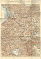
 Transcaucasia and Ararat - map of page 20.jpg 1,181 × 1,806; 323 KB
-

-

-
 Asian part of the Ottoman Empire and South Caucasus (1879).jpg 9,468 × 7,299; 18.67 MB
-
 DAVIS(1879) p030 MAP OF ASIA MINOR, SHEWING THE DISTRICT VISITED BY DAVIS.jpg 2,395 × 1,597; 2.3 MB
-
 DAVIS(1879) p040 ROUTE MAP TO ILLUSTRATE DAVIS' JOURNEYS IN CILICIA.jpg 4,355 × 2,156; 4.56 MB
-
 DAVIS(1879) p469 PLAN OF THE RUINES OF THE CITY OF ISAURA.jpg 2,014 × 1,358; 1.49 MB
-

-


.jpg)
_With_numerous_maps_and_notes%27_(11110341044).jpg)
_With_numerous_maps_and_notes%27_(11109755666).jpg)


.jpg)
.jpg)
_p030_MAP_OF_ASIA_MINOR,_SHEWING_THE_DISTRICT_VISITED_BY_DAVIS.jpg)
_p040_ROUTE_MAP_TO_ILLUSTRATE_DAVIS%27_JOURNEYS_IN_CILICIA.jpg)
_p469_PLAN_OF_THE_RUINES_OF_THE_CITY_OF_ISAURA.jpg)
_With_numerous_maps_and_notes%27_(11109535923).jpg)
_With_numerous_maps_and_notes%27_(11108763105).jpg)