Category:1860s maps of the Austrian Empire
Jump to navigation
Jump to search
Subcategories
This category has the following 5 subcategories, out of 5 total.
'
- 1860s maps of Austria (5 F)
.
- 1860s maps of Czechia (7 F)
- 1860s maps of Hungary (5 F)
- 1860s maps of Montenegro (8 F)
Media in category "1860s maps of the Austrian Empire"
The following 10 files are in this category, out of 10 total.
-
 1860 Map Of The Austrian Empire, Italian States, Turkey In Europe and Greece.jpg 5,057 × 4,409; 4.4 MB
-
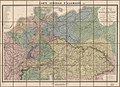
 Carte générale de l'Allemagne comprenant l'ensemble des etats de l'Europe centrale LOC 2015591062.tif 11,512 × 8,309; 273.67 MB
-
 1862 Stieler Map of Northern Germany - Geographicus - StaatenDeutschen-perthes-1862.jpg 3,132 × 2,600; 1.57 MB
-
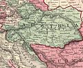
 Johnson's Austria, Turkey in Europe and Greece.jpg 15,042 × 10,842; 41.66 MB
-

-

-
 Johnson, A.J. Europe. 1864.F.jpg 1,996 × 2,335; 1.38 MB
-
 Johnson, A.J. Europe. 1864.F.Austria Hungary.jpg 1,668 × 1,368; 672 KB
-

-


_(NYPL_b13663520-1510833).jpg)


