Category:1850s maps of Iran
Jump to navigation
Jump to search
Countries of Asia: Afghanistan · Armenia‡ · Azerbaijan‡ · People's Republic of China · Cyprus‡ · Egypt‡ · Georgia‡ · India · Indonesia‡ · Iran · Iraq · Japan · Jordan · Lebanon · Pakistan · Philippines · Russia‡ · Syria · Turkey‡
Limited recognition: Abkhazia‡ · Taiwan · State of Palestine
‡: partly located in Asia
Limited recognition: Abkhazia‡ · Taiwan · State of Palestine
‡: partly located in Asia
Subcategories
This category has only the following subcategory.
Media in category "1850s maps of Iran"
The following 14 files are in this category, out of 14 total.
-
 1850 Mitchell Map of Arabia, Persia, Afghanistan - Geographicus - Arabia-mitchell-1850.jpg 3,500 × 2,865; 2.77 MB
-
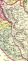
 Mitchell Map 1850 country of Balochistan.jpg 1,235 × 737; 442 KB
-
 Persia Arabia etc. LOC 2013593007.jpg 5,193 × 4,058; 3.4 MB
-
 Persia Arabia etc. LOC 2013593007.tif 5,193 × 4,058; 60.29 MB
-
 Persia, Arabia, etc - 1852.png 1,310 × 1,024; 2.42 MB
-
 1853 - Map of the Ottoman Empire, the Black Sea and the frontiers of Russia and Persia.jpg 15,482 × 10,565; 15.87 MB
-
 Die Asiatische Türkei, die Kaukasusländer und West-Persien von H. Kiepert.jpg 8,277 × 6,713; 20.61 MB
-
 Joseph Grassl, 1855, Persien.PNG 2,235 × 1,820; 7.46 MB
-
 Persia Arabia etc. LOC 2004629242.jpg 4,976 × 4,153; 4.1 MB
-
 Persia Arabia etc. LOC 2004629242.tif 4,976 × 4,153; 59.12 MB
-
 Colton, G.W. Turkey In Asia And The Caucasian Provinces Of Russia. 1856 (H).jpg 1,014 × 2,168; 767 KB
-
 Atlas over alle Jordens Dele - no-nb digibok 2010021603001-35.jpg 3,924 × 3,217; 2.36 MB
-
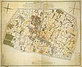 Tehran1857.jpg 10,200 × 8,328; 13.74 MB
-
 Le Tour du monde-02-p019.jpg 888 × 856; 218 KB


.jpg)


