Category:1820s maps of Iran
Jump to navigation
Jump to search
Countries of Asia: Afghanistan · Armenia‡ · Azerbaijan‡ · People's Republic of China · Egypt‡ · Georgia‡ · India · Indonesia‡ · Iran · Iraq · Japan · Lebanon · Myanmar · Pakistan · Philippines · Russia‡ · Syria · Turkey‡ · Turkmenistan
Limited recognition: Abkhazia‡ · State of Palestine
‡: partly located in Asia
Limited recognition: Abkhazia‡ · State of Palestine
‡: partly located in Asia
Media in category "1820s maps of Iran"
The following 10 files are in this category, out of 10 total.
-
 PG 1820.jpg 536 × 419; 72 KB
-
 Adrien-Hubert Brué. Asie-Mineure, Armenie, Syrie, Mesopotamie, Caucase. 1822 (J).jpg 1,297 × 1,544; 383 KB
-

-

-
 Louis Vivien de Saint-Martin. Carte General de la Turquie d'Asie. 1824 (A).jpg 3,291 × 5,290; 3.27 MB
-

-
 Louis Vivien de Saint-Martin. Carte General de la Turquie d'Asie. 1824 (J).jpg 3,291 × 2,150; 1.31 MB
-
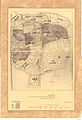
 First Tehran map 1826.jpg 596 × 633; 145 KB
-
 Tabriz map 1827.jpg 1,706 × 2,500; 2.36 MB
-
 Iran(Persia) and Caucasus.jpg 6,085 × 8,796; 8.42 MB

.jpg)
.jpg)
.jpg)
.jpg)
.jpg)
.jpg)


_and_Caucasus.jpg)