Category:1850s maps of the Philippines
Jump to navigation
Jump to search
- Provinces of the Philippines
- Province-level divisions (independent cities, Metro Manila)
Media in category "1850s maps of the Philippines"
The following 12 files are in this category, out of 12 total.
-

-

-
-
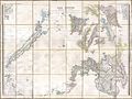
 T.V.(1857) - (10) MAPA DE LAS ISLAS FILIPINAS Y MARIANAS.jpg 3,201 × 2,169; 1.61 MB
-
 L'Indocina (India Transgangetica) le insole Filippine.png 10,026 × 7,827; 105.55 MB
-

-
 Admiralty Chart No 2391 Ports in the Philippine Islands, Published 1855.jpg 5,980 × 8,128; 23.7 MB
-
 Admiralty Chart No 2576 Sulu Archipelago, Sulu & Celebes Sea, Published 1858.jpg 11,518 × 7,821; 39.78 MB
-
 Calamianes.jpg 2,379 × 2,575; 2.75 MB
-

-

-


_-_(10)_MAPA_DE_LAS_ISLAS_FILIPINAS_Y_MARIANAS.jpg)
;_with_sailing_directions_for_Palawan_Passage_and_Island_(by_W._T._Bate)%27_(11237077305).jpg)


.jpg)
_le_insole_Filippine.png)