Category:1845 maps of Iowa
Jump to navigation
Jump to search
Media in category "1845 maps of Iowa"
The following 5 files are in this category, out of 5 total.
-
 1845 Iowa Map (IA 1845IowaMap).pdf 3,781 × 3,068; 4.4 MB
-
 1845 CareyAndHart 01.png 3,665 × 4,281; 13.95 MB
-
 1845 CareyAndHart Close Up Iowaville.jpg 3,264 × 2,448; 1.89 MB
-
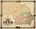
 1845 Tanner.JPG 403 × 820; 71 KB
-
 A new map of Iowa - accompanied with notes by W. Barrows LOC 2007626856.tif 10,084 × 8,186; 236.17 MB


