Category:1840s maps of Palestine
Jump to navigation
Jump to search
Subcategories
This category has the following 2 subcategories, out of 2 total.
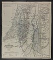
Media in category "1840s maps of Palestine"
The following 19 files are in this category, out of 19 total.
-

-
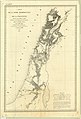 1840 Pelet map of Syrie Méridionale and Palestine.jpg 7,236 × 10,644; 7.64 MB
-
 Carte de la Palestine ou Terre Sainte LOC 2012590215.tif 7,657 × 10,193; 223.3 MB
-
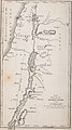 Demonstration of the truth of the Christian religion.. (1844) (14779821911).jpg 2,340 × 4,208; 1.95 MB
-

-

-
 1847 Jean van de Cotte map of Palestine.jpg 9,158 × 11,229; 17.03 MB
-

-
 Übersichtskarte der Nilländer.. (NYPL b14291191-37502).jpg 4,120 × 5,477; 5.2 MB
-

-
 Heinrich Kiepert 1841 map of Palestine (combined).jpg 5,627 × 12,456; 21.72 MB
-
 IsraelMapByRabbiJosephSchwarzAt1847.JPG 3,392 × 5,780; 3.25 MB
-
-
 Karte von Palästina oder dem heiligen Lande.jpg 6,112 × 8,500; 11 MB
-
 Kiepert Palestine North 1841.jpg 6,024 × 6,887; 7.57 MB
-
 Kiepert Palestine South 1841.jpg 6,105 × 6,913; 6.51 MB
-
 Map of the River Jordan and Dead Sea by W. F. Lynch.png 1,024 × 1,954; 2.98 MB
-

-
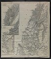
 Ritter map of Palestine 1840.jpg 14,060 × 17,913; 45.4 MB


_(14779821911).jpg)
.jpg)


%27_(11030344986).jpg)
.jpg)

.jpg)

_(cropped).jpg)


