Category:1840s maps of Lebanon
Jump to navigation
Jump to search
Countries of Asia: Afghanistan · Armenia‡ · Azerbaijan‡ · People's Republic of China · Cyprus‡ · Egypt‡ · Georgia‡ · India · Indonesia‡ · Iran · Iraq · Japan · Lebanon · Pakistan · Philippines · Russia‡ · Syria · Turkey‡ · Turkmenistan · Uzbekistan
Limited recognition: Abkhazia‡ · Taiwan · State of Palestine
‡: partly located in Asia
Limited recognition: Abkhazia‡ · Taiwan · State of Palestine
‡: partly located in Asia
Media in category "1840s maps of Lebanon"
The following 5 files are in this category, out of 5 total.
-

-
 1840 Pelet map of Syrie Méridionale and Palestine.jpg 7,236 × 10,644; 7.64 MB
-
 1843 map of Syria by the SDUK.jpg 7,681 × 9,723; 10.55 MB
-
 Map of Syria, Ancient and Modern.jpg 15,317 × 22,786; 59.87 MB
-
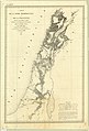
 1844 map of Druze Lebanon.jpg 650 × 1,146; 577 KB


