Category:1840s maps of New York (state)
Jump to navigation
Jump to search
States of the United States: Alabama · Alaska · Arkansas · California · Connecticut · Delaware · Florida · Georgia · Hawaii · Idaho · Illinois · Indiana · Iowa · Kentucky · Louisiana · Maine · Maryland · Massachusetts · Michigan · Minnesota · Mississippi · Missouri · Montana · Nebraska · New Hampshire · New Mexico · New York · North Dakota · Ohio · Oklahoma · Oregon · Pennsylvania · Rhode Island · South Carolina · South Dakota · Tennessee · Texas · Utah · Vermont · Virginia · Washington · Wisconsin · Wyoming – Washington, D.C.
Puerto Rico
Puerto Rico
Subcategories
This category has the following 7 subcategories, out of 7 total.
- 1846 maps of New York (state) (10 F)
- 1848 maps of New York (state) (12 F)
N
Media in category "1840s maps of New York (state)"
The following 3 files are in this category, out of 3 total.
-
 Buffalo Creek Reservation in 1841 map.tif 2,289 × 1,495; 146 KB
-
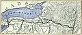 Erie-canal 1840 map.jpg 819 × 355; 312 KB
-
 New York Presidential Election Results 1844.svg 496 × 390; 139 KB

