Category:1838 maps of Massachusetts
Jump to navigation
Jump to search
Subcategories
This category has only the following subcategory.
Media in category "1838 maps of Massachusetts"
The following 8 files are in this category, out of 8 total.
-
 1838 Boston map byJohnTallis M8774.png 807 × 644; 872 KB
-
 Embossed map of Nantucket Island and vicinity. LOC 99440241.jpg 2,129 × 2,886; 783 KB
-
 1838 TremontRow map Tallis Boston BPLM8774.png 804 × 712; 1.07 MB
-
 A map of Cambridge, Mass. LOC 75697136.jpg 7,768 × 5,672; 4.56 MB
-
 Boston, 1838 (2675250002).jpg 1,267 × 2,000; 2.44 MB
-
 Map of Massachusetts (2675561606).jpg 2,000 × 1,492; 3.72 MB
-
 Map of the island of Nantucket, including Tuckernuck (2675206996).jpg 2,000 × 1,414; 2.19 MB
-
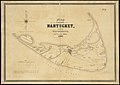
 Nantucket and Tuckernuck - 1838.jpg 1,132 × 800; 222 KB


.jpg)
.jpg)
.jpg)
