Category:1840 maps of Massachusetts
Jump to navigation
Jump to search
Media in category "1840 maps of Massachusetts"
The following 6 files are in this category, out of 6 total.
-
 1840 Boston map byGeorgeWBoynton SamuelNDickinson 10937.png 803 × 684; 953 KB
-
 Map of Massachusetts, Rhode Island, and Connecticut LOC 2007626185.jpg 8,800 × 7,385; 11.51 MB
-
 Map of Massachusetts, Rhode Island, and Connecticut LOC 2007626185.tif 8,800 × 7,385; 185.93 MB
-
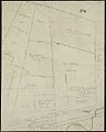
 Map of the railroads of Massachusetts running west from Boston (3855707941).jpg 2,000 × 1,059; 1.96 MB
-
-
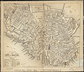 Plan of the city of Boston (2674416495).jpg 2,000 × 1,739; 3.57 MB


.jpg)
.jpg)
.jpg)