Category:1835 maps of Massachusetts
Jump to navigation
Jump to search
Subcategories
This category has only the following subcategory.
Media in category "1835 maps of Massachusetts"
The following 13 files are in this category, out of 13 total.
-
 1835 Cornhill map Stimpson Boston BPL12253.png 810 × 713; 1.03 MB
-
 1835 SouthCove map Boston BPL 2675248746.jpg 1,882 × 1,028; 1.1 MB
-

-

-
-

-

-
 Plan of Boston with parts of the adjacent towns (2674427051).jpg 2,000 × 1,473; 2.84 MB
-
 Plan of Boston with parts of the adjacent towns (2675246530).jpg 2,000 × 1,419; 2.27 MB
-
 South Cove, in Boston (2675247834).jpg 2,000 × 1,673; 2.77 MB
-
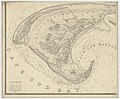
 The town of Boston in New England (2674907291).jpg 2,000 × 1,581; 2.21 MB
-
 The town of Boston in New England LOC 76692113.jpg 8,129 × 5,770; 5.74 MB
-
 The town of Boston in New England LOC 76692113.tif 8,129 × 5,770; 134.19 MB


.jpg)
.jpg)
.jpg)
.jpg)
_(2675212654).jpg)
.jpg)
.jpg)
.jpg)
.jpg)
