Category:1800 maps of Europe
Jump to navigation
Jump to search
Temperate regions: North America · South America · Africa · Europe · Asia · – Polar regions: – Other regions:
English: 1800 maps of Europe
Español: Mapas de Europa en 1800
Suomi: Euroopan kartat vuodelta 1800
Română: Hărți ale Europei din 1800
Subcategories
This category has the following 13 subcategories, out of 13 total.
'
.
A
F
G
I
L
- 1800 maps of Lithuania (3 F)
N
- 1800 maps of Norway (127 F)
P
- 1800 maps of Portugal (2 F)
S
- 1800 maps of Spain (3 F)
Media in category "1800 maps of Europe"
The following 6 files are in this category, out of 6 total.
-
 A General History for Colleges and High Schools - Map 20 Part 1.png 1,818 × 2,884; 7.58 MB
-
 A General History for Colleges and High Schools - Map 20 part 2.png 1,886 × 2,911; 7.21 MB
-
 An accurate map of Europe from the best authorities (3046039588).jpg 2,000 × 1,663; 3.19 MB
-

-
 Spain and Portugal, from the best authorities (3045239243).jpg 2,000 × 1,672; 3.31 MB
-
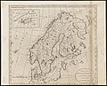 Sweden, Denmark, Norway and Finland, from the best authorities (3046039688).jpg 2,000 × 1,614; 2.83 MB


.jpg)

.jpg)
.jpg)