Category:1810 maps of Europe
Jump to navigation
Jump to search
Temperate regions: North America · South America · Africa · Europe · Asia · – Polar regions: – Other regions:
English: 1810 maps of Europe
Español: Mapas de Europa en 1810
Suomi: Euroopan kartat vuodelta 1810
Română: Hărți ale Europei din 1810
Subcategories
This category has the following 4 subcategories, out of 4 total.
Media in category "1810 maps of Europe"
The following 7 files are in this category, out of 7 total.
-
 Cadastre Saint-Coulitz section du bourg.jpg 5,480 × 8,168; 2.83 MB
-
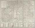
 Europe according to the best authorities LOC 85695483.jpg 4,681 × 4,277; 2.64 MB
-
 Europe according to the best authorities LOC 85695483.tif 4,681 × 4,277; 57.28 MB
-
 Plan des havres et port de Dahouët - btv1b53064827f.jpg 11,784 × 8,179; 10.96 MB
-
 Plan SPB 1810 cropped.jpg 4,655 × 4,179; 3.66 MB
-
 Plan SPB 1810.jpg 10,100 × 5,200; 18.14 MB
-


