Category:1780s maps of the Balkans
Jump to navigation
Jump to search
English: This category is intended to collect maps from the 1780s that show multiple Balkan countries in one map frame.
Subcategories
This category has the following 6 subcategories, out of 6 total.
B
- 1780s maps of Bulgaria (5 F)
C
- 1780s maps of Croatia (5 F)
G
R
- 1780s maps of Romania (4 F)
S
- 1780s maps of Serbia (5 F)
Media in category "1780s maps of the Balkans"
The following 19 files are in this category, out of 19 total.
-
 Rigobert-Bonne-Atlas-de-toutes-les-parties-connues-du-globe-terrestre MG 9987.tif 5,137 × 3,541; 52.08 MB
-
 Ungarn BV044689595.jpg 10,950 × 8,236; 9.67 MB
-

-

-
 Hungary with Turky in Europe.jpg 2,676 × 2,196; 288 KB
-
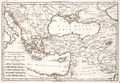
 William Faden. Composite Mediterranean. 1785.I.jpg 1,968 × 2,195; 1.2 MB
-
 1785 map - Turchia d'Europa - divisa nelle sue provincie, e governi - di nuova projezione.jpg 8,303 × 11,048; 15.1 MB
-
 1788 - Kriegstheater oder Graenzkarte Oesterreichs, Russlands, und der Türkey.jpg 9,186 × 6,267; 10.65 MB
-
 1788 map of the Western Balkan.jpg 17,528 × 12,184; 51.87 MB
-

-

-
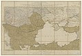
 Schwarzmeer-Gebiet BV001315927.jpg 12,079 × 8,666; 10.97 MB
-

-
 1789 - Neueste Karte Von Der Moldau, Walachei, Bessarabien Und Der Krim.jpg 6,022 × 5,550; 10.81 MB
-
 Albanien BV000855857.jpg 6,612 × 4,673; 20.85 MB
-
 Albanien BV000855859.jpg 6,646 × 4,666; 21.8 MB
-
 Dalmatien BV000855863.jpg 6,289 × 4,679; 20.47 MB
-
 Dalmatien BV000855865.jpg 6,262 × 4,646; 3.83 MB
-
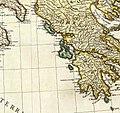 William Faden. Composite Mediterranean. 1785.R.jpg 1,218 × 1,143; 400 KB


