Category:1700s maps of the Balkans
Jump to navigation
Jump to search
English: This category is intended to collect maps from the 1700s that show multiple Balkan countries in one map frame.
Subcategories
This category has the following 6 subcategories, out of 6 total.
Media in category "1700s maps of the Balkans"
The following 6 files are in this category, out of 6 total.
-
 KKR-22 Turquie en Europe.jpg 1,511 × 1,054; 296 KB
-
 1700 map of the Turkish Empire in Europe.jpg 15,693 × 13,435; 39.12 MB
-
 Fluminum princeps Danubius - CBT 5873405.jpg 5,715 × 4,750; 8.23 MB
-
 "Карта Венгрии".jpg 5,295 × 3,871; 3.94 MB
-

-
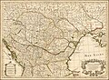
 Regnorum Hungariae, Dalmatiae, Croatiae, Serviae et Principatus Transylvaniae, 1705.jpg 1,966 × 1,700; 4.8 MB


