Category:1770s maps of the Balkans
Jump to navigation
Jump to search
English: This category is intended to collect maps from the 1770s that show multiple Balkan countries in one map frame.
Subcategories
This category has the following 4 subcategories, out of 4 total.
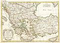
Media in category "1770s maps of the Balkans"
The following 5 files are in this category, out of 5 total.
-
 KKR-8 Mappa geographica Græciæ Septentrionalis Hodiernæ sive Provinciarum Macedoniæ.jpg 4,548 × 3,568; 1.83 MB
-
-
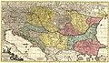 1771 map of the Balkan Peninsula by Johann Michael Probst.jpg 13,941 × 7,974; 23.08 MB
-
 Kärnten BV044689731.jpg 11,630 × 8,778; 11.24 MB
-


_Robert_de_Vaugondy_G%C3%A9ographe_ord(inaire)_du..._-_btv1b550137444_(112_of_183).jpg)