Category:1749 maps of Africa
Jump to navigation
Jump to search
Media in category "1749 maps of Africa"
The following 17 files are in this category, out of 17 total.
-
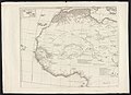
 Africa - DPLA - 53cf8d0a26ad8394db1fec64e4f85882.jpg 1,000 × 774; 252 KB
-

-

-

-
-

-

-

-
 Bellin Plan de L'Isle de Goré 1749 UTA.jpg 3,428 × 2,546; 2.72 MB
-
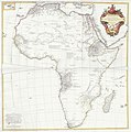 D'Anville Afrique 1749 UTA.jpg 9,966 × 10,021; 9.19 MB
-

-

-
 Les Isles du Cap-Verd (2674660885).jpg 2,000 × 1,570; 2.17 MB
-
-

-
 Resized-inu-afrmap-4004510-recto-master.png 3,500 × 3,500; 14.98 MB
-
 Robert de Vaugondy Les Isles du Cap-Verd 1749 UTA.jpg 2,411 × 2,131; 3.71 MB


r_d%27Anville_avec_privil%C3%A8ge_-_btv1b530093208_(1_of_2).jpg)
r_d%27Anville_avec_privil%C3%A8ge_-_btv1b530093208_(2_of_2).jpg)
_;_Grav%C3%A9_par_Guill%27Delahaye_-_btv1b530999998.jpg)


.jpg)
.jpg)
.jpg)

