Category:1745 maps of Africa
Jump to navigation
Jump to search
Temperate regions: North America · South America · Africa · Europe · Asia · – Polar regions: – Other regions:
| ← 1740 1741 1742 1743 1744 1745 1746 1747 1748 1749 → |
Media in category "1745 maps of Africa"
The following 14 files are in this category, out of 14 total.
-
 Africa 1745, Guillaume Delisle (3993456-recto).jpg 9,327 × 6,725; 11.31 MB
-
 A map of the coast and country about Sierra Lione and Sherbro River (5961368826).jpg 1,525 × 2,000; 2.86 MB
-
 Afm0002151.jpg 4,000 × 3,023; 2.88 MB
-
 Africa - DPLA - 169a378044d2791c234f6b72c5fb66b5.jpg 1,000 × 753; 285 KB
-
 Africa Map 1745 (rus).jpg 2,376 × 1,860; 2.84 MB
-
 Afrique - DPLA - 9edf50dd164319105da2918c9170bc6b.jpg 1,000 × 770; 273 KB
-
 AMH-8166-KB Map of Cape Verde and view of Goeree.jpg 1,774 × 2,400; 576 KB
-
 An accurate map of the coast of Cape de Verde (5961364712).jpg 1,471 × 2,000; 2.33 MB
-

-
 Ein großer Teil Afrikas zur Illustration der Kirchengeschichte.png 5,260 × 4,556; 38.54 MB
-

-
 Map of the coast and islands between Cape Roxo and the Isle of Tassagan (5961364340).jpg 2,000 × 1,628; 2.83 MB
-
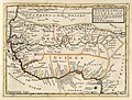 Negroland and Guinea - DPLA - 0301aeb562206a56672aaab9ba66bc75.jpg 1,000 × 756; 257 KB
-

.jpg)
.jpg)


.jpg)


.jpg)


,_NG-501-62.jpg)
.jpg)

