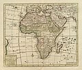
Category:1750 maps of Africa
Jump to navigation
Jump to search
Temperate regions: North America · South America · Africa · Europe · Asia · – Polar regions: – Other regions:
| ← 1750 1751 1752 1753 1754 1755 1756 1757 1758 → |
Media in category "1750 maps of Africa"
The following 15 files are in this category, out of 15 total.
-
1750 Bellin Map of Cape Town, South Africa - Geographicus - Gundriss-bellin-1750.jpg 3,375 × 2,722; 1.45 MB
-
1750 Bellin Map of the Senegal - Geographicus - Senegal-bellin-1750.jpg 1,985 × 2,784; 1.13 MB
-
AMH-8104-KB Map of the Bay of Mozambique.jpg 1,796 × 2,400; 670 KB
-
Carta Generale del Africa - DPLA - 7df68dc999eadb6df3531a0b1356c725.jpg 1,000 × 790; 279 KB
-
Emanuel Bowen, A new and accurate map of Nubia & Abissinia (FL13723585 2493169).jpg 7,512 × 6,391; 66.54 MB
-
L'Afrique - btv1b53009084d.jpg 5,798 × 6,465; 5.5 MB
-
LAfrique (2673919159).jpg 2,000 × 1,427; 2.81 MB
-
Reinier Ottens, Nieuwe Caarte van Kaap de Goede Hoop en't Zuyderdeel van Africa (FL13724047 2493837).jpg 10,617 × 8,830; 127.43 MB
-
Tirion Nieuwe Kaart van Africa c.1750 UTA.jpg 4,275 × 3,642; 6.19 MB


