Category:1720s maps of London
Jump to navigation
Jump to search
Ceremonial counties of England: Greater London ·
City-counties:
Former historic counties:
Other former counties:
City-counties:
Former historic counties:
Other former counties:
Subcategories
This category has only the following subcategory.
Media in category "1720s maps of London"
The following 25 files are in this category, out of 25 total.
-
 Image taken from page 799 of 'Old and New London, etc' (11188580334).jpg 1,924 × 1,821; 997 KB
-

-
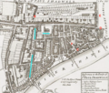 Strype St Paul's Shadwell map.png 1,870 × 1,583; 6.26 MB
-
 Strype, map of Whitechapel, 1720.jpg 2,560 × 1,600; 1.52 MB
-
 The eastern suburbs of London in Elizabethan times.jpg 1,826 × 702; 629 KB
-

-

-

-
 40 of 'St John the Evangelist, Westminster- parochial memorials' (11214608945).jpg 2,336 × 1,480; 593 KB
-
 London 1724.jpg 874 × 608; 150 KB
-
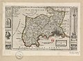 Midlesex - By H. Moll Geographer - btv1b530568320.jpg 4,248 × 3,120; 2.1 MB
-
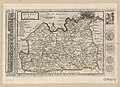 Surrey - By H. Moll Geographer - btv1b53056455n.jpg 4,080 × 2,952; 2.07 MB
-
 A plan delineating Defoe's circuit. Wellcome L0005007.jpg 1,666 × 1,178; 1.02 MB
-
 1727 London Map by Danet.jpg 3,292 × 2,412; 2.41 MB
-
 Image taken from page 657 of 'Old and New London, etc' (11192139154).jpg 1,892 × 1,631; 945 KB
-

-

-
 London in the Roman Period, Stukeley, 1720.jpg 2,672 × 4,000; 1.78 MB
-
 Parish-St-George-Hanover-Square.jpg 712 × 529; 119 KB
-

-

-
 Plan de la ville de Londres et de Westminster... - btv1b530105476.jpg 7,744 × 5,850; 8.92 MB
-

-
 Plan of the parish of St. George's, Hanover Square Wellcome L0005008.jpg 1,600 × 1,310; 988 KB
-

.jpg)
.jpg)


.jpg)
.jpg)
%27_(16589767345).jpg)
.jpg)


.jpg)
.jpg)
.jpg)


_Les_Forces_de_l%27Europe,_Asie,_Afrique_et_Amerique_Comme_a,_RP-P-OB-83.035-16.jpg)