Category:1800s maps of London
Jump to navigation
Jump to search
Media in category "1800s maps of London"
The following 16 files are in this category, out of 16 total.
-
 Fairburn's map of the country twelve miles round London (35048881181).jpg 1,482 × 2,000; 2.95 MB
-
 John Fairburn 7.5. 1800.jpg 2,804 × 1,674; 475 KB
-
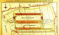
 Tollgates London 1801.jpg 1,400 × 1,029; 308 KB
-
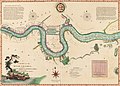 A chart of the River Thames from London Bridge to Woolwich Warren (CBL Wep 4095.83).jpg 11,147 × 8,022; 43.63 MB
-
 St Giles parish, London 1804.jpg 1,693 × 1,273; 2.46 MB
-
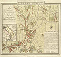
 Clerkenwell 1805 Cartographer; Tyrer, James.jpg 712 × 758; 253 KB
-
 Islington E Baker 1805.jpg 712 × 656; 221 KB
-
 1806 Mogg Pocket or Case Map of London, England - Geographicus - London-mogg-1806.jpg 7,000 × 3,813; 7.83 MB
-
 002osd000000020u00104000.jpg 4,000 × 2,410; 3.46 MB
-
 A plan of London, Westminster, and Southwark (5384794369).jpg 2,000 × 1,312; 2.76 MB
-
 Limehouse Cut at the beginning of the 19th century.jpg 2,407 × 1,568; 1.47 MB
-

-
 Archway plan.jpg 800 × 507; 54 KB
-
 City of London 1809 (map) Laurie & Whittle 07767.jpg 1,280 × 853; 391 KB
-
 Drawing, map (BM Ee,4.88).jpg 2,085 × 1,515; 297 KB
-
 South London Map 1800.jpg 753 × 559; 205 KB
.jpg)


.jpg)


.jpg)

.jpg)

_Laurie_%26_Whittle_07767.jpg)
.jpg)
