Category:1650s maps of the world
Jump to navigation
Jump to search
| 17th-century maps of the world: ← 1600s 1610s 1620s 1630s 1640s 1650s 1660s 1670s 1680s 1690s → |
English: This category is supposed to hold world maps created in the 1650s.
Media in category "1650s maps of the world"
The following 32 files are in this category, out of 32 total.
-
 1650 Jansson Map of the Ancient World - Geographicus - OrbisTerrarum-jansson-1650.jpg 3,500 × 2,762; 2.87 MB
-
-
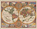
 A-3-37-01-World-Hemispheres.jpg 3,000 × 2,240; 979 KB
-
 A-3-37-02-World-Hemispheres.jpg 3,000 × 2,234; 890 KB
-
 A-3-37-03-World-Hemispheres.jpg 3,000 × 2,277; 873 KB
-
 A-3-37-35-Hemisphere-Arctic-Antarctic.jpg 3,000 × 2,282; 828 KB
-
 A-3-37-36-World-Hemisphere.jpg 3,000 × 2,219; 912 KB
-
 1652 map of the world by Claes Jansz. Visscher (II).tif 6,668 × 4,992; 190.49 MB
-
-

-
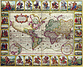
 Orbis Terrarum Tipus de Integro Multis in Locis Emendatus.jpg 8,500 × 5,096; 14.45 MB
-

-

-

-

-
-
 Gulf1..JPG 3,072 × 2,304; 3.12 MB
-
 Orbis Terrarum Nova et Accuratissima Tabula by Nicolaes Visscher, 1658.jpg 2,950 × 2,478; 1.64 MB
-
 OrbisPictus b 218.jpg 1,396 × 1,390; 571 KB
-
 OrbisPictus b 219.jpg 1,416 × 1,392; 629 KB
-
-
 "Nova et accuratíssima totíus Terrarum Orbis tabula" (22270602751).jpg 4,033 × 3,024; 1.94 MB
-

-

-
 A plat of all the world - Norman B. Leventhal Map Center at the BPL.jpg 2,000 × 1,343; 2.37 MB
-

-
 Claes Visscher's World Map.jpg 1,722 × 1,400; 4.71 MB
-
 Doncker sea atlas world map.jpg 760 × 575; 200 KB
-
 Map - Special Collections University of Amsterdam - OTM- HB-KZL 31-01-14.tif 7,144 × 6,007; 122.78 MB
-
 Map - Special Collections University of Amsterdam - OTM- HB-KZL 31-01-15.tif 7,272 × 5,991; 124.65 MB
-
 World RMG K1010.jpg 1,280 × 922; 1.52 MB
-
 WrightMoxon-PlatofAlltheWorld-1657-large.jpg 2,800 × 1,880; 1 MB


.jpg)
.jpg)
.jpg)
.jpg)
.jpg)


_-_btv1b52511195b_(09_of_85).jpg)
.jpg)
.jpg)


