Category:1610s maps of the world
Jump to navigation
Jump to search
| 17th-century maps of the world: ← 1600s 1610s 1620s 1630s 1640s 1650s 1660s 1670s 1680s 1690s → |
English: This category is supposed to hold world maps created in the 1610s.
Subcategories
This category has the following 2 subcategories, out of 2 total.
N
Media in category "1610s maps of the world"
The following 17 files are in this category, out of 17 total.
-
 Universale Descrittione Di Tutto Il Mondo Del Eccte. Giuseppe Rosaccio.jpg 7,904 × 6,630; 10.41 MB
-
 Bodleian Libraries, Edward Wright, Chart of the World.jpg 1,000 × 675; 171 KB
-
 Biao du shuo.jpg 1,766 × 3,200; 633 KB
-
 1611 Novissima &c. Hondius.jpg 2,887 × 2,254; 6.14 MB
-
 Print of Pietro Vesconte's world map by Johann Bongars.jpg 8,434 × 8,225; 16.36 MB
-

-

-
 Terrestrial globe gores. LOC 2008627640.jpg 9,318 × 4,384; 5.81 MB
-
 Terrestrial globe gores. LOC 2008627640.tif 9,318 × 4,384; 116.87 MB
-
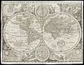
 1616 Typus Orbis Terrarum Bertius.jpg 1,797 × 1,310; 2.56 MB
-

-
 1907 facsimile of the Hondius' 1610s world map.jpg 46,498 × 30,000; 301.6 MB
-
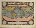 Abraham Ortelius - Theatrum orbis terrarum.jpg 1,002 × 797; 419 KB
-

-
 Map of the world. Wellcome L0051173.jpg 6,557 × 5,060; 12.44 MB
-
 Right half of Eredia's Typus Orbis Terrarum.jpg 1,905 × 1,393; 490 KB
-


.jpg)


s_Planis_Hemisphaerii_(s_com)_prehes._Nic._Geilekerck,_fecit_-_btv1b53069786t_(1_of_2).jpg)


