Category:1650s maps of Europe
Jump to navigation
Jump to search
Temperate regions: North America · South America · Africa · Europe · Asia · Oceania – Polar regions: – Other regions:
Subcategories
This category has the following 48 subcategories, out of 48 total.
.
B
- 1650s maps of Belgium (10 F)
- 1650s maps of Bulgaria (empty)
C
- 1650s maps of Croatia (3 F)
- 1650s maps of Cyprus (1 F)
D
- 1650s maps of Denmark (19 F)
E
F
G
H
- 1650s maps of Hungary (5 F)
I
- 1650s maps of Ireland (10 F)
L
N
P
- 1650s maps of Portugal (10 F)
R
- 1650s maps of Romania (1 F)
- 1650s maps of Russia (7 F)
S
- 1650s maps of Slovenia (1 F)
- 1650s maps of Sweden (8 F)
- 1650s maps of Switzerland (15 F)
T
- 1650s maps of Turkey (6 F)
U
W
- 1650s maps of Wales (5 F)
Media in category "1650s maps of Europe"
The following 6 files are in this category, out of 6 total.
-
 Geographia Sacra.jpg 12,797 × 10,083; 24.34 MB
-
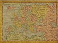 Europe 1659.jpg 800 × 600; 130 KB
-
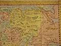 Europe, 1659 northeast.jpg 800 × 600; 129 KB
-
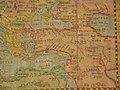
 Europe, 1659 northwest.jpg 800 × 600; 124 KB
-
 Europe, 1659 southeast.jpg 800 × 600; 128 KB
-
 Europe, 1659 southwest.jpg 800 × 600; 129 KB


