Category:1650s maps of England
Jump to navigation
Jump to search
Media in category "1650s maps of England"
The following 13 files are in this category, out of 13 total.
-
 The River of Tyne leading from the Sea on the east, to Newcastle... (BM Q,6.125).jpg 2,500 × 2,078; 1.02 MB
-
 A Guide for Travellers and the Plaine Mans Map (...) (BM Q,6.134).jpg 2,500 × 2,063; 1.27 MB
-
 UBBasel Map Grönland Island Britische Inseln 1657 Kartenslg Mappe 247-52.tif 10,579 × 8,337, 2 pages; 252.36 MB
-

-

-
-

-
 A New Description of Kent (BM 1853,0611.123 2).jpg 2,500 × 1,947; 669 KB
-
 A New Description of Kent (BM 1853,0611.123).jpg 2,239 × 889; 591 KB
-
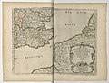
 Print, broadside, map (BM Mm,3.52).jpg 2,500 × 1,990; 1.84 MB
-
 A New Description of Kent (BM 1853,0611.123 1).jpg 2,380 × 591; 407 KB
-
 Print, book-illustration, map (BM 1977,U.367.1).jpg 2,500 × 2,000; 644 KB
-
 Print, map (BM 1868,0808.3229).jpg 2,500 × 2,076; 1.56 MB
.jpg)
_(BM_Q,6.134).jpg)
.jpg)
.jpg)
.jpg)
.jpg)
.jpg)
.jpg)
.jpg)
.jpg)
.jpg)
.jpg)