Category:1630s maps of Paris
Jump to navigation
Jump to search
Subcategories
This category has only the following subcategory.
Media in category "1630s maps of Paris"
The following 10 files are in this category, out of 10 total.
-
 1633 – Carte du Gouvernement de l’Ile-de-France.jpg 6,656 × 5,432; 5.16 MB
-
 Carte du Vexin Beauvoisis et Hurepoix 1634.jpg 8,789 × 6,592; 34.74 MB
-
 Carte du Vexin Beauvoisis et Hurepoix 1634.tif 8,789 × 6,592; 165.79 MB
-

-
-
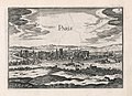
 Christophe Tassin, Paris - P. 213. Paris, 1636 - David Rumsey.jpg 4,557 × 4,021; 10.25 MB
-
 Edouard, L'Entrepôt à Tivoli, 1633 - Gallica.jpg 8,458 × 10,346; 14.8 MB
-

-
-


.jpg)

