Category:1560s maps of Egypt
Jump to navigation
Jump to search
Countries of Asia: People's Republic of China · Cyprus‡ · Egypt‡ · India · Iran · Pakistan · Russia‡ · Turkey‡
Limited recognition: State of Palestine
‡: partly located in Asia
Limited recognition: State of Palestine
‡: partly located in Asia
Media in category "1560s maps of Egypt"
The following 7 files are in this category, out of 7 total.
-
 Egypt 1561, Girolamo Ruscelli (3824971-recto).png 3,628 × 2,752; 16.02 MB
-
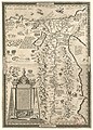 Aegyptus - (Abraham Ortelius) - btv1b5964076p.jpg 5,624 × 7,816; 8.65 MB
-
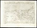
 Africa Northeast 1561, Girolamo Ruscelli (3824671-recto).png 3,656 × 2,732; 16.42 MB
-
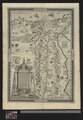
 Egitto Nvova Tavola - DPLA - 76913dd802b1296e45b179154b1f3b8c.jpg 1,000 × 756; 234 KB
-
 Egypt - DPLA - 3ff7d75271731d98aabd6af0555495b9.jpg 637 × 1,000; 206 KB
-
 UBBasel Map 1561 Kartenslg AA 95-95a Asia.tiff 12,587 × 9,590, 2 pages; 540.18 MB
-
 UBBasel Map 1565 Kartenslg AA 115 Aegyptos.tiff 6,685 × 9,645, 2 pages; 184.5 MB
.png)
_-_btv1b5964076p.jpg)
.png)

