
Category:1550s maps of Egypt
Countries of Africa: Egypt‡
‡: partly located in Africa
‡: partly located in Africa
Media in category "1550s maps of Egypt"
The following 3 files are in this category, out of 3 total.
-
 Eastern Mediterranean and Aegean Sea. Battista Agnese, PORTOLAN ATLAS (Italy ca. 1550).jpg 6,808 × 4,673; 8.35 MB
-
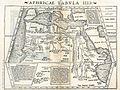 Aphricae Tabula IIII.jpg 1,431 × 1,078; 2.11 MB
-

.jpg)

.jpg)