Category:1560s maps of Africa
Jump to navigation
Jump to search
Temperate regions: North America · South America · Africa · Europe · Asia · – Polar regions: – Other regions:
Subcategories
This category has the following 8 subcategories, out of 8 total.
- 1561 maps of Africa (15 F)
- 1562 maps of Africa (13 F)
- 1564 maps of Africa (4 F)
- 1565 maps of Africa (1 F)
- 1566 maps of Africa (1 F)
- 1569 maps of Africa (4 F)
E
- 1560s maps of Egypt (7 F)
S
- 1560s maps of Sudan (empty)
Media in category "1560s maps of Africa"
The following 14 files are in this category, out of 14 total.
-
 Il disegno della geografia moderna de tutta la parte dell' Africa.jpg 34,566 × 25,346; 230.36 MB
-
 1565 West Africa Ramusio Delle Navigationi vol3 pp430-431.png 1,116 × 879; 2.71 MB
-
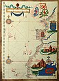 Sebastião Lopes 1575.jpg 2,232 × 3,100; 4.32 MB
-
 Africa Minor Nuova Tavola," 1561 ed. (North Central Africa).jpg 1,016 × 750; 159 KB
-
 Africa Minor Nvova Tavola - DPLA - 309a261636fc200f83be6f3b6b1d227f.jpg 1,000 × 759; 262 KB
-
 Africa Nvova Tavola - DPLA - 54ab9bd5f670caef210115cf2cc4f68d.jpg 1,000 × 763; 279 KB
-

-

-
 Egnazio Danti - Madagascar - Google Art Project.jpg 4,702 × 9,406; 22.05 MB
-
 Lázaro Luis 1563.jpg 2,519 × 3,636; 7.12 MB
-
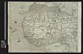
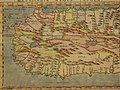 Mauritania Nuova Tavola.jpg 800 × 600; 126 KB
-
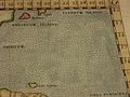 Tabula Aphricae I (Northwest Africa) northeast.jpg 800 × 600; 108 KB
-
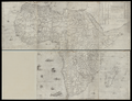 The Drawing of the Modern Geography of the Whole Africa WDL6764.png 1,342 × 1,024; 2.45 MB
-
 UBBasel Map 1564 Kartenslg AA 110-113.tif 14,037 × 9,132, 4 pages; 1.39 GB


.jpg)


,_Portugal_-_Image_146054.jpg)


_northeast.jpg)
