This is an archive of past discussions. Do not edit the contents of this page. If you wish to start a new discussion or revive an old one, please do so on the current talk page.
According to RFU, UA managed to push RU away from 0506 road. Small blue arrow should be added (smaller attacks than this one were added e.g. Pisky). Berobalkan (talk) 15:40, 9 May 2023 (UTC)
Done! Note: As much as I enjoy watching Reporting from Ukraine, it is not a reliable source. However, since the ISW reported on this counterattack and they are considered a reliable source as of now, I added the arrow. Physeters✉01:42, 10 May 2023 (UTC)
Thanks anyway. I reckon that RFU is quite reliable, although it's quite optimistic and the changes on the frontline are often prematurely published. I just hope that the incoming Ukrainian counterattack will be announced in all sources! Berobalkan (talk) 07:44, 10 May 2023 (UTC)
I also watch Reporting from Ukraine (along with Denys Davydov) pretty much every night! I think it's a great channel especially when it comes to explaining the frontline, but their reports do seem somewhat optimistic at times. Johnson524 (talk) 19:18, 10 May 2023 (UTC)
Ivanivske
I think we should remove Ivanivske because it makes the map unclear. Main focus is on Klishchiivka and Khromove, not Ivanivske that much. At first I thought to move the label, but it's not possible now. Berobalkan (talk) 13:25, 14 May 2023 (UTC)
I sort of agree that the Bakhmut area is quite crowded, so maybe we should remove it. Let's put it to a vote. Physeters✉21:56, 14 May 2023 (UTC)
I think it'd be best to remove it, solely for how crowded the area is getting compared to the rest of the map. It's certainly an important settlement for its proximity to Bakhmut, but has not had the same threat of complete capture compared to its neighbor Khromove. Johnson524 (talk) 00:56, 15 May 2023 (UTC)
I'm not yet sure what's going on, but there appears to be thousands of requests being made to https://svgtranslate.toolforge.org/File:2022_Russian_invasion_of_Ukraine.svg and they're (mostly) failing because the time to process the SVG exceeds 30 seconds (maybe because there are ~38k tspans and text elements?). SVG Translate keeps going offline because of this, and so for now I've blocked translating of this file in particular just so the tool continues to work for everything else. Will update here soon. Sorry for this!! — Sam Wilson ( Talk • Contribs ) … 07:07, 18 May 2023 (UTC)
That was me. Someone dropped a note about it on my talk page about a week ago because SVG Translate would not run, and I fixed it. Physeters✉20:16, 18 May 2023 (UTC)
@Glrx and Physeters: Thanks for looking into it (and fixing that other issue). It doesn't seem to be an issue with the actual SVG, because it's working fine on my local installation of SVG Translate, but every change in translation takes almost a minute to process. I'm looking into what bits of the code are taking the longest; there might be improvements to be made. It may also be that this file is just getting too big for SVG Translate — I guess it's reasonable to have a limit at some point (I guess to number of labels, rather than just size of the SVG). But will see what else can be done first! — Sam Wilson ( Talk • Contribs ) … 02:29, 19 May 2023 (UTC)
@Glrx and Physeters: We've done a bit of work on it, and released version 1.2.3 of the tool, and unblocked this file for translation. Hopefully it'll at least stop failing now, although it's still very slow. We've talked about adding a hard limit to the number of translatable elements, but haven't done so yet. — Sam Wilson ( Talk • Contribs ) … 07:12, 24 May 2023 (UTC)
@Physeters, can you just add a date label for the capture? I can add it, but 1. I don't know how to write dates 2. there is simply no space for it. Berobalkan (talk) 13:21, 22 May 2023 (UTC)
I see someone has reverted the file back, so maybe we should debate Bakhmut's status for a little while before we change the map. Physeters✉18:24, 22 May 2023 (UTC)
There is no consensus. Ukraine denies that Bakhmut has fallen and has kept launching attacks in its surroundings. According to the ISW, Ukraine still holds a small, practically useless part of Bakhmut. This file should be updated according to Wikipedia articles, and not contradict them. Super Dromaeosaurus (talk) 10:24, 23 May 2023 (UTC)
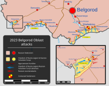
The one thing is that adding incursions into Russia might me out of scope for this file, as it is meant to document the "Russian invasion of Ukraine." I might be in the minority here, but I feel that it is better for it to have its own map, such as this one.2023 Belgorod Oblast attacksPhyseters✉20:13, 23 May 2023 (UTC)
Oh, I didn't know there was already a separate SVG file for the Belgrod attacks, thanks for bringing that to my attention @Physeters, I withdraw my support for adding these attacks to the map. Cheers! Johnson524 (talk) 00:40, 24 May 2023 (UTC)
In the caption of the file it is said that in red are "Ukrainian territories occupied by Russia and pro-Russian separatists". The part in bold should be removed as it's been many months since DPR and LPR were annexed. Their armies are now formally part of the Russian Armed Forces and Russia takes responsibility for whatever they do. Super Dromaeosaurus (talk) 13:50, 23 May 2023 (UTC)
I changed the header text for many (but not all) languages. If the second line is blank, I've made it be "-" to avoid a problem with SVG Translate. SVG Translate can be used to edit the other languages, but please do not make a blank line; use "-".
The map shows that Bakhmut has already been taken, but when is it taken? If you are not in the course, then here is the date of taking: 20-05-2023 Defenrob (talk) 15:44, 4 June 2023 (UTC)
I don't think. Army that controlled these cities is always the same (in this case the Russian army). That doesn't relate to military. FrozedCourgette (talk) 15:26, 12 June 2023 (UTC)
I thought years were added a while ago for this very reason; maybe they got lost in some other edit. Yes, they should be used. -sche (talk) 23:39, 9 June 2023 (UTC)
The plan was to add years for non-2022 dates. Only two dates have 2023 on the English version. The default date text is an ISO date string (e.g., 2023-06=09). I can force the years into all languages using a script. Glrx (talk) 00:41, 10 June 2023 (UTC)
I think including a year for all dates would be best. Especially at this point, something like "22 March" isn't immediately clear if it means 2022 or 2023, especially for dates along the current front line. - Odin (talk) 17:20, 12 June 2023 (UTC)
Yeah, I think showing the year for all dates is best, as Odin says, it's otherwise unclear which "29 May" the lone yellow marker under Lysychansk refers to, and which "18 April" the markers around Kreminna are for, etc. -sche (talk) 21:39, 13 June 2023 (UTC)
I've added years, but now there is trouble with the legend: the first line is left aligned, but subsequent lines are centered.. Clicking through to the SVG shows the legend correctly. Does not seem to be Thumbor 7.3.2 versus Thumbor 6.3.2. Glrx (talk) 02:44, 14 June 2023 (UTC)
Found the issue. Current librsvg does not center this text correctly:
Can we remove the line breaks (in which case, please implement the fix :) ), or is that something where they will just be readded by Inkscape next time someone edits the file in Inkscape? -sche (talk) 03:30, 16 June 2023 (UTC)
Actually, Inkscape fixes the problem. The file is now back to normal.
I messed up when I pasted the SVG into a text editor: I did not revert the editor's automatic reformatting of the file (the editor added the line breaks).
It gets worse for many translations. I have a fix that uses SVG filters to supply the background, but it needs to change the class on the date labels from class="date" to class="dateuk". WMF's thumbnailer does neither attribute selection nor class conjunction. Glrx (talk) 20:09, 16 June 2023 (UTC)
I turned off the labelru and labeluk groups that were the background for date displays. The use elements are still there; they can be removed later if the change is acceptable. The date text elements now have a dateru or a dateuk classes that use filters to paint a red background (opacity 0.5) or a yellow background (opacity 0.75). The filter backgrounds adjust to the size of the text. Glrx (talk) 02:32, 17 June 2023 (UTC)
New York (vandalism?)
On the map (in Eastern Ukraine on the “Ukrainian controlled” side) there is a town labelled “New York”. I suspect it’s not actually called that and this is vandalism. Can this be confirmed? 197.234.165.14718:20, 22 June 2023 (UTC)
Yes please. It's confusing that there are so many arrows from the beginning of the invasion. Or alternatively, there should be separate maps for separate parts of the campaign, say now for the counteroffensive, starting from 1 June 2023. AncientWalrus (talk) 08:01, 12 June 2023 (UTC)
because a bunch of dates just makes the map more understandable, i have to disagree. The information may not be irrelevant, but it clusters the view. Also the dates lack a year - we are now well over a year into this and without a year atached to the moths it is anyones guess when what did happen. Adtonko (talk) 17:23, 15 June 2023 (UTC)
Yeah, I've thought for a while about suggesting we clean this map up a bit, e.g. drop most or all of the (old, non-recent) arrows and just tint the area that Russia captured and Ukraine recaptured in the initial phase (around Kyiv and Nova Odesa) one tint (say, light blue, like the tails of the arrows), tint the area recaptured in the second phase (around Kherson and Izyum) a second tint (e.g. a somewhat darker blue), and be ready to tint anything recaptured in this latest counteroffensive a third tint. This would follow the segmentation of many of the organizations which have been mapping this conflict, from news sources to the ISW (which notably "cleaned" the blue 'recaptured territory' tint off their map after the first phase to more clearly show the second phase, and then cleaned that off recently to more clearly show what happens during this phase). -sche (talk) 21:37, 13 June 2023 (UTC)
Recent evidence has come to light that PMC Wagner has staged a mutiny against the Kremlin and has now marched into Rostov-on-Don and occupied it, along with large swaths of Voronezh Oblast. Would it be possible that we could incorporate this into the map? 2600:387:15:2013:0:0:0:A13:42, 24 June 2023 (UTC)
If the conflict stays over the border, I would be open to expanding the map eventually. We can cross that bridge when it comes (no pun intended). Magog the Ogre (talk) (contribs) 17:31, 24 June 2023 (UTC)
Map View
I propose to mark the territories liberated by Ukraine, which were previously controlled by Russia, in blue. Such designations are on maps of the occupation of specific oblasts (for example: ), in my opinion, it is the most convenient. Block Baby (talk) 11:27, 26 June 2023 (UTC)
I agree with it. Liberated territories are more visible. Also, the same colors should be used for marking territories occupied before and after 2022. Berobalkan (talk) 16:09, 27 June 2023 (UTC)
I broadly agree it'd be helpful to mark liberated territory (in some way more visible than just the dashed lines marking the former extent of Russian control we have at present), but I'm concerned that using only one shade of blue for all deoccupied territory no matter when it was liberated makes it hard to track the progress of the ongoing offensive (and this would've been true at the start of the Izyum/Kherson phase, too). A lot of other RS tracking this conflict either "clear" the map in between major phases for precisely that reason (as ISW did, removing the indications of territory recaptured around Kyiv once the Izyum/Kherson phase began, and removing that before this current phase), or use different colours for different major phases, which I think might be the clearest approach. Perhaps we use different shades of blue (and as a backup for colourblind people, outline the land recaptured in each phase in a slightly thicker line)? -sche (talk) 06:10, 28 June 2023 (UTC)
This seems like a very thoughtful proposal
This seems like a proposal that would improve the map. I support this and especially with different degrees as suggested by @-sche. Zorblin (talk) 13:13, 30 June 2023 (UTC)
Kakhovka Reservoir
As mapped by the ISW and noted by other sources, the Kakhovka Reservoir is drying up. Should we update the map to reflect this, e.g. leaving the outline of its former extent but making 'resurfaced' land yellow? (One wonders if Ukraine will attack across the new land...) -sche (talk) 22:36, 26 June 2023 (UTC)
I agree that the Kakhovka Reservoir should be redrawn, but current satellite imagery is a little unclear in showing where the new land ends and the water begins. When it is sufficiently clear where the new coastline lies, I will update the map. Also, the new land would have to be marked grey, unless either side makes efforts to control it. Physeters✉20:12, 27 June 2023 (UTC)
That part of the map looks a bit empty. I think we should add some cities/settlements in the first line, e.g. Robotyne, Nesterianka, Staromairoske... It would make the map more understandable because currently it looks like nothing is happening. Berobalkan (talk) 08:31, 25 July 2023 (UTC)
Ukrainians are literally in front of the settlement. Frontline is basically on the entrance of the settlement. Can it be moved? Berobalkan (talk) 13:59, 27 July 2023 (UTC)
... according to the detailed map. Also, attacks on Vuhledar decreased so there is no danger for Vuhledar to be captured. Berobalkan (talk) 08:24, 25 July 2023 (UTC)
Vuhledar is divided into two parts, a northwestern part which Ukraine fully controls, and a southeastern part, which is split between Russian and Ukrainian forces. This makes Vuhledar contested & means the detailed map needs to be updated. Physeters✉02:43, 27 July 2023 (UTC)
I don't understand what you mean. As far as I know, Russia is currently in complete control of Pryiutne. Could you please explain your comment further? Physeters✉23:48, 27 July 2023 (UTC)
According to many maps, including Google Maps and Deep State, northern part of Pryiutne is under Ukrainian control. Berobalkan (talk) 09:34, 28 July 2023 (UTC)
I now understand what you mean. Unfortunately, Deepstate does not currently show Ukraine in control of northern Pryiutne. It shows Ukrainian forces immediately north of Pryiutne, but not in any part of the settlement. Also, GoogleMyMaps maps (which I believe you are referring to) are not created by Google itself, but by individual users, which means they cannot be considered reliable sources. Physeters✉06:32, 30 July 2023 (UTC)
The following discussion is closed. Please do not modify it. Subsequent comments should be made on the appropriate discussion page. No further edits should be made to this discussion.
Looks like a recent edit removed the legend from the defs element. The legend needs to be in the definitions so some translations appear in the first 250 kB of the file.
The discussion above is closed. Please do not modify it. Subsequent comments should be made on the appropriate discussion page. No further edits should be made to this discussion.
Kakhovka resevoir color
The grey color of the resevoir looks to me like a mix of red and blue, which could lead some to mistake it as jointly-occupied or contested territory. Any thoughts on changing the color? Vetrenarisisum (talk) 02:32, 31 July 2023 (UTC)
I think it should be kept as it was before. We don't have any maps of the reservoir today (I don't mean satellite images) so we don't have to be responsible on how to potray this area. Super Dromaeosaurus (talk) 10:36, 31 July 2023 (UTC)
I chose grey as the color for the former reservoir as "grey zone" is a common phrase describing areas not controlled by either side, however its color could be changed. I made the change because it was requested in a previous discussion, which has since been archived.
I disagree with @Super Dromaeosaurus's comment, since at some point in to not-so distant future, either Ukraine or Russia is going to occupy this new territory. Just because most maps still show it as being a reservoir doesn't mean it is, or that we can't show it as it really is. Open Street Map, an open-source mapping service, actually has mapped the new terrain in the reservoir basin, so to say that there are no maps of the reservoir today is incorrect. Physeters✉06:02, 1 August 2023 (UTC)
Interesting. So it is based on Open Street Map? Fine by me then. Maybe it could be worth adding to the file's description as I don't believe there's a lot of maps including this new terrain. The ISW or DeepStateMap for example do not. I think most people will not be familiar with this. Super Dromaeosaurus (talk) 08:51, 1 August 2023 (UTC)
The ISW's interactive map actually as a very high detailed map of the new river courses and islands (even higher than OSM's map), though you have to zoom in to see it. I did base the Dnipro's new course off Open Street Map, since it is a much more established mapmaker than the ISW. I do agree that the rivers new course may be unfamiliar, but I don't foresee the situation changing anytime soon, so it will remain the status quo for sometime, and therefore become better understood. Physeters✉09:34, 1 August 2023 (UTC)
Since snake island is represented by a dot, it wouldn't be colored blue because none of the other liberated dots are colored blue. Vetrenarisisum (talk) 02:11, 3 August 2023 (UTC)
Missing Raion centers
Almost all Raion centers are present on the map, but four are missing: Kosiv (Ivano-Frankivsk Oblast), Verkhovyna (Ivano-Frankivsk Oblast), Vyzhnytsia (Chernivtsi Oblast), Tiachiv (Zakarpattia Oblast). Please consider adding those to the map. Shwabb1 (talk) 04:50, 27 July 2023 (UTC)
Yes. I like the idea. Besides the missing cities, some parts of those oblasts are really empty (especially Zakarpattia Oblast). Berobalkan (talk) 14:02, 27 July 2023 (UTC)
Then maybe Chop can be added, which is an important railway junction into Slovakia and Hungary. Though, there aren't many settlements in northeastern Zakarpattia Oblast as that part mostly consists of mountains and forests. As the villages in that area don't have much importance, I don't see many reasons to add them to the map. Shwabb1 (talk) 04:59, 28 July 2023 (UTC)
Done! Note: I used the name Danube for the label since it is the most common and recognizable name for the river in English. Physeters✉06:17, 4 August 2023 (UTC)
Map View
I propose to mark the territories liberated by Ukraine, which were previously controlled by Russia, in blue. Such designations are on maps of the occupation of specific oblasts (for example: ), in my opinion, it is the most convenient. Block Baby (talk) 11:27, 26 June 2023 (UTC)
I agree with it. Liberated territories are more visible. Also, the same colors should be used for marking territories occupied before and after 2022. Berobalkan (talk) 16:09, 27 June 2023 (UTC)
I broadly agree it'd be helpful to mark liberated territory (in some way more visible than just the dashed lines marking the former extent of Russian control we have at present), but I'm concerned that using only one shade of blue for all deoccupied territory no matter when it was liberated makes it hard to track the progress of the ongoing offensive (and this would've been true at the start of the Izyum/Kherson phase, too). A lot of other RS tracking this conflict either "clear" the map in between major phases for precisely that reason (as ISW did, removing the indications of territory recaptured around Kyiv once the Izyum/Kherson phase began, and removing that before this current phase), or use different colours for different major phases, which I think might be the clearest approach. Perhaps we use different shades of blue (and as a backup for colourblind people, outline the land recaptured in each phase in a slightly thicker line)? -sche (talk) 06:10, 28 June 2023 (UTC)
This seems like a very thoughtful proposal
This seems like a proposal that would improve the map. I support this and especially with different degrees as suggested by @-sche. Zorblin (talk) 13:13, 30 June 2023 (UTC)
I suggest changing the librated region to a more distinct color such as green or a different shade of yellow since it is hard to distinguish water from these regions. Harpsichord246 (talk) 23:09, 30 July 2023 (UTC)
This is a good point; this blue turns out to be not-so-distinct from water (and resurfaced Kakhovka land). I don't know if a deeper blue would be better, or just using a darker yellow than the 'base' terrain yellow. Maybe someone can mock up what various colours would look like. -sche (talk) 14:54, 8 August 2023 (UTC)
Oppose: I take up the objection by Harpsichord246 and other users above. The OP wanted the map to be yellow and blue for nationalistic purposes (POV?), but it turned out to be illegible, since we cannot distinguish lakes and rivers anymore. In this war, rivers like the Dnieper represent a very important border, or front line, and losing this visual demarcation line is a lost for the file value. I suggest to use green to mark the recaptured lands (as discussed below, the word "liberated" is POV too). Daniele Fisichella18:55, 15 August 2023 (UTC)
Yep, I just updated it. I apologize for not doing it sooner, but I have been quite busy over the last couple of days. Physeters✉06:32, 18 August 2023 (UTC)
View
Hi, in my opinion, it would be better to mark the territories occupied until February 24, 2022 with a darker shade of red rather than orange. Cities occupied before February 24, 2022 would be better marked in red, as well as cities occupied after February 24, 2022. Block Baby (talk) 11:04, 12 August 2023 (UTC)
One idea would be to use a much richer, darker shade of blue, differentiating it from the water. Another would be to use crosshatching, although maybe that makes it less clear where exactly it covers. Actually, another idea would be to just use a darker shade of yellow. Perhaps someone can mock up some swatches of what various colours look like next to the existing yellow and red (and water blue). -sche (talk) 19:37, 20 August 2023 (UTC)
Can someone please remove the (blue) scribbling near Kherson?
Can the map please just be updated (on advances) by changing the ground colour like normal, instead of just scribbling on it? 197.234.165.14715:05, 24 August 2023 (UTC)
The blue lines south of Kherson are actually the small streams separating the various islands in the Dnipro delta. Multiple people have been confused by them, so I will simplify them to make the area more clear. Physeters✉23:47, 24 August 2023 (UTC)
I'm not sure if this is what you are referring to, but there are a lot of "coast" lines south of Kherson that don't look intentionally placed. - Odin (talk) 21:46, 20 August 2023 (UTC)
The various blue lines south of Kherson represent the islands of the Dnipro Delta and the small streams that separate them. Physeters✉02:59, 21 August 2023 (UTC)
Just asking, don't you think it would be better to simplify and forge it into one big chunk or combine it with the mainland so it can be easier understood and be a little less hard to edit personally for you? Valenox (talk) 14:11, 21 August 2023 (UTC)
The map was originally like this, but a whole ago, somebody requested that the Dnipro delta be better traced. Russia and Ukraine have been fighting over the individual islands for some time now, and the area was very poorly drawn on the old map. If enough people want it, I will combine the islands together, though I personally believe showing the individual islands is better.
Also it's actually not hard at all for me to edit that area. The way the map is constructed makes updating the front quite easy, even in complicated areas like the Dnipro delta. Physeters✉17:36, 21 August 2023 (UTC)
The current version does feel more readable to me, yes. I do wonder if it would make sense to prioritize the front line dotted red line over the river borders in this section and if that would improve clarity. I realized part of the issue was (as you mentioned somewhere else on the page) that this section of the map was incorrectly depicted for a long time and I initially mistook the correction as an error. I also think ultimately changing the color of Ukraine's regained territory could help with areas close to water like this one, but that's a different discussion. - Odin (talk) 20:00, 25 August 2023 (UTC)
Bilmak and legend
1. Bilmak was renamed to Kamianka in 2021, but this map still labels it as Bilmak.
2. The description for the red color in the legend is "Ukrainian territories occupied by Russia-". Does the hyphen serve any purpose? I feel like it was added on accident. If that's the case, it should be removed. Shwabb1 (talk) 13:09, 23 August 2023 (UTC)
The Bilmak v Kamianka is listed in the #Wikidata section above. What should be done?
The hyphen is a workaround for an SVG Translate issue. An empty tspan may be removed, and then SVG Translate will get confused. The hyphen keeps the tspan around.
Kamianka is the official name since 2021. As per this article, the original name of the settlement was Kamianka, then Tsarekostiantynivka (in Russian Empire), then Kuibysheve (in USSR), then Bilmak (as per 2016 decommunization laws), and again Kamianka (as decided by the Verkhovna Rada due to requests from locals).
Ok, thank you for explaining the hyphen problem. Perhaps this should be added to commonly asked questions? I'm sure I'll not be the only person to notice the hyphen.
Just found another one - Yuvileine in Luhansk Oblast should be Katerynivka, as per the 2016 decommunization laws. Shwabb1 (talk) 10:04, 25 August 2023 (UTC)
The wording in the map legend should be changed from "Liberated Ukrainian territory" to "Recaptured Ukrainian territory" so the map is written from a neutral point of view. Liberated is a non-neutral word. – Treetoes023 (talk) 00:01, 13 August 2023 (UTC)
Recaptured is definitely a more appropriate term for a non-partisan project like our own. I've updated the English language, but I lack the knowledge to fix in Arabic, Polish, or Ukrainian. Magog the Ogre (talk) (contribs) 01:32, 13 August 2023 (UTC)
@Lucasoliveira653: Well yes, but also no; the legality of Russia annexing parts of Ukraine is disputed (specifically by Russia). In order to keep a neutral point of view, we must avoid wording that favors one side over the other. As much as I hate Russia, it is extremely important that editors prevent their biases (as well as the biases of others) from affecting any and all Wikimedia projects. Neutrality isn't always easy, and sometimes it will even come into conflict with your moral compass, but it is necessary for providing unbiased information. I hope you understand where I am coming from. – Treetoes023 (talk) 21:30, 14 August 2023 (UTC)
Of course does Russia dispute this. But the case is absolutely clear: These annexation ARE illegal. It is a wrong understanding of "neutral point of view" to say something is unclear when it actually is very clear and just those who break international law say it would be unclear. When some people say "water is not wet" we also don't say "it is disputed that water would be wet". -- Chaddy (talk) 23:04, 15 August 2023 (UTC)
Support per OP. We are not here to judge any side, nor the legality of the Russian military operation. Most NATO interventions all around the world have been illegal, just like almost every war in history. We impudently invaded multiple countries and committed shameful war crimes, yet no article one-sidedly judges us for that. We need a neutral point of view. "Recaptured" is way better than the POV-oriented "liberated". Daniele Fisichella18:37, 15 August 2023 (UTC)
Jesus Christ, people. This has nothing to do with what is illegal, who committed war crimes, or anyone's logical fallacies. It's about using neutral language for an international project. This isn't that fucking hard. Magog the Ogre (talk) (contribs) 00:21, 17 August 2023 (UTC)
Well, if something is in fact illegal, it would not be neutral to say that it is disputed if it is illegal. Using "neutral language" therefore not always is neutral. -- Chaddy (talk) 12:58, 17 August 2023 (UTC)
@Chaddy: No, I see you literally missed the point of my previous comment: war may be nationally repudiated and considered illegal (e.g. in Switzerland, or NATO countries like Belgium and Italy), but no war is in fact illegal, since they don't rely on national legal systems. International law allows and regulates war just like any other aspect of international politics. Daniele Fisichella19:42, 26 August 2023 (UTC)
Just noting that Est. 2021's rollback to the 22:11 13 August 2023 revision unfixed a few unrelated things (it readded "Kharkiv" to the name of one place, which had been removed per a discussion above, and added a stray hyphen to the text about red in the legend), if anyone wants to refix those. -sche (talk) 15:46, 17 August 2023 (UTC)
Why is there a hyphen (-) in this map's legend in the description for the red symbols after "Ukrainian territories occupied by Russia"? None of the other symbols have a hyphen in their descriptions, can someone remove it? – Treetoes023 (talk) 02:44, 27 August 2023 (UTC)
@Glrx: Oh okay. Is there a way to prevent the SVG Translate from getting confused if the tspan is removed? If not, is there a way to keep the tspan but remove the hyphen, or is it the only sensible way to keep the tspan? It is not that big of a deal if the hyphen stays, I just think that it looks a little weird and out of place on the map. – Treetoes023 (talk) 02:39, 28 August 2023 (UTC)
The hyphen is there to keep SVG Translate from removing the tspan. If the hyphen is removed, then SVG Translate removes the tspan and then promptly gets confused because SVG Translate does not know how to translate a one-line label to a two-line label. Using a non-breaking space would confuse editors. The workaround right now is to use a character that is visible (a hyphen) but is not very noticeable. Glrx (talk) 03:25, 28 August 2023 (UTC)
Spelling
While looking through the villages and towns on the map, I noticed multiple misspellings: "Borshciv" should be Borshchiv, "Shyryajave" should be Shyriaieve, Yuzhnoukrainsk Nuclear Power Plant should be South Ukraine Nuclear Power Plant (as per its name change in 2022). I also noticed one thing that is probably more important - many settlements do not use the same Romanization style as larger cities (for example, Sokyryany instead of Sokyriany, and Kamin'-Kashyrs'kyi instead of Kamin-Kashyrskyi). Are there any plans on fixing this issue? Shwabb1 (talk) 05:11, 28 July 2023 (UTC)
Done! I fixed as many incorrect transliterations as I could find. If you find any more, please let me know and I'll fix them. Physeters✉06:15, 4 August 2023 (UTC)
Thanks, I just looked through some of the Oblasts and so far I found the following: Shyriaiave should be Shyriaieve, Kobelyaky should be Kobeliaky, Rozsozhentsi should be Rozsoshentsi. Shwabb1 (talk) 03:26, 7 August 2023 (UTC)
I did a WikiData query to find human settlements in Ukraine.
SELECTDISTINCT?place?placeLabel?oblastLabel?location?population?nativeWHERE{?placewdt:P31/wdt:P279*wd:Q12051488.# populated place in Ukraine?placewdt:P625?location.# coordinates of the locationoptional{?placewdt:P1082?population.}# population# filter (?population >= 2000) .# ?place wdt:P131* ?oblast . # located in an administrative region (Kyiv like Washington DC?)# ?oblast wdt:P31 wd:Q3348196. # that is a Ukrainian oblast# located in an admin regionoptional{?placewdt:P1705?native.}SERVICEwikibase:label{bd:serviceParamwikibase:language"en"}}Order by?placeLabel
I compared those (English) place names to the default names in the map. Out of 658 places, 59 did not match the primary WikiData placeLabel (aliases were not considered):
Place Kobelyaky not found JSSVGWork.html:1367:49
Place Lokvytsia not found JSSVGWork.html:1367:49
Place Verkhnia Syrovatka not found JSSVGWork.html:1367:49
Place Orzhytsya not found JSSVGWork.html:1367:49
Place Pereshchepyne not found JSSVGWork.html:1367:49
Place Zaporizhzhia NuclearPower Plant not found JSSVGWork.html:1367:49
Place Novoarkhanhelsk not found JSSVGWork.html:1367:49
Place Holovanivsk not found JSSVGWork.html:1367:49
Place Shyriaiave not found JSSVGWork.html:1367:49
Place Bilokorovychi not found JSSVGWork.html:1367:49
Place Lyubar not found JSSVGWork.html:1367:49
Place Bronyky not found JSSVGWork.html:1367:49
Place Chernyakhiv not found JSSVGWork.html:1367:49
Place Chernobyl NuclearPower Plant not found JSSVGWork.html:1367:49
Place Khmelnytskyi NuclearPower Plant not found JSSVGWork.html:1367:49
Place Rivne NuclearPower Plant not found JSSVGWork.html:1367:49
Place Koryst not found JSSVGWork.html:1367:49
Place Zdolbuniv not found JSSVGWork.html:1367:49
Place Rozhyshche not found JSSVGWork.html:1367:49
Place Zhovka not found JSSVGWork.html:1367:49
Place Novoiavorivske not found JSSVGWork.html:1367:49
Place Svaliava not found JSSVGWork.html:1367:49
Place Dynaivtsi not found JSSVGWork.html:1367:49
Place Novo Ushytsia not found JSSVGWork.html:1367:49
Place Feodosiia not found JSSVGWork.html:1367:49
Place Kerch not found JSSVGWork.html:1367:49
Place Sevastopol not found JSSVGWork.html:1367:49
Place Simferopol not found JSSVGWork.html:1367:49
Place Sudak not found JSSVGWork.html:1367:49
Place Saky not found JSSVGWork.html:1367:49
Place Yevpatoriia not found JSSVGWork.html:1367:49
Place Dzhankoi not found JSSVGWork.html:1367:49
Place Krasnoperekopsk not found JSSVGWork.html:1367:49
Place Armiansk not found JSSVGWork.html:1367:49
Place Snake Island not found JSSVGWork.html:1367:49
Place Shyrokyi not found JSSVGWork.html:1367:49
Place South Ukraine NuclearPower Plant not found JSSVGWork.html:1367:49
Place Lyptsi not found JSSVGWork.html:1367:49
Place Banychi not found JSSVGWork.html:1367:49
Place Nedashky not found JSSVGWork.html:1367:49
Place Bilmak not found JSSVGWork.html:1367:49
Place Askaniia-Nova not found JSSVGWork.html:1367:49
Place Novodnistrovsk not found JSSVGWork.html:1367:49
Place Azovstal Metallurgical Combine not found JSSVGWork.html:1367:49
Place Rubizhne, Kharkiv not found JSSVGWork.html:1367:49
Place New York not found JSSVGWork.html:1367:49
Place Udy not found JSSVGWork.html:1367:49
Place Volokhiv Yar not found JSSVGWork.html:1367:49
Place Chornobyl not found JSSVGWork.html:1367:49
Place Tiachiv not found JSSVGWork.html:1367:49
DONE. 658 places -> 59 not found, 599 found
Comments on random sample of names:
Armiansk (Q688716) is listed as in Russia (not a Ukrainian settlement). Applies to many Crimean locations.
Chernobyl (Q129677) uses less common transliteration; no longer a populated place...
I have not checked all names. Right now, I am more interested in location matching to get the correct WikiData item.
Glrx (talk) 20:56, 11 August 2023 (UTC)
Chernobyl still had about 1,000 residents before the war, so it is not fully depopulated. The Ukrainian letter "и" should be transliterated as "y" making Udy correct & the letter "я" at the beginning of a word should be transliterated as "Ya", making Volohkiv Yar correct. Physeters✉23:11, 11 August 2023 (UTC)
Thanks. Some of the comments are about Wikidata search criteria. Wikidata should use standard transliterations. The inconsistencies imply that either the map or the Wikidata item should be changed. Glrx (talk) 23:29, 11 August 2023 (UTC)
I don't know what database you are using to pull the Ukrainian names (is it Wikidata?) but numbers 1, 4, 6, 7, 8, 9, and 13 are incorrect. They should be Стрий, Татарбунари, Агаймани, Вільнянськ, Глеюватка, Чистопіль and Містки respectively, making all of their current transliterations correct. 2, 3, 5, 10, 11 and 12 all seem have the correct Ukrainian names, so I will fix their transliterations shortly. Physeters✉21:28, 12 August 2023 (UTC)
These present questions about the Ukrainian spelling and my transliterations. I do not know Ukainian. The accent is only present on these Ukrainian translations:
Bad transliteration for rubizhne, kharkiv, rubízhne, kharkivská óblast (Рубі́жне, Харківська́ о́бласть)
The accents in Ukrainian, Russian, and Belarusian are only written in dictionaries so that people know how to pronounce the word correctly. In pretty much any other context, the accents are not used. Shwabb1 (talk) 03:32, 13 August 2023 (UTC)
The Kharkiv qualifier for Rubizhne is probably no longer needed. I added it when both it and the large town of Rubizhne in Luhansk Oblast were in the news at about the same time. Also, like Shwabb1 said, the accents are not used in common writing. Physeters✉05:49, 13 August 2023 (UTC)
Wikidata
I tried matching location names in the SVG to Ukrainian settlements in Wikidata. Here are the SVG location names that did not match.
Some sources [1] [2] also refer to them as the "Boyko Towers", as a reference for anyone looking up additional information. Unfortunately I did not see info on where specifically these are located, but it would be great to have them added to the map if the locations are known. - Odin (talk) 18:52, 12 September 2023 (UTC)
We should wait for now. Ukraine is having strong pressure on Russian forces in Verbove, but it's not yet confirmed whether Ukrainian forces entered Verbove or not. Berobalkan (talk) 11:02, 23 September 2023 (UTC)
What do you mean by "the official web site of the counteroffensive"? Do you mean the Wikipedia article? Also, there really isn't any room to add Dachi to the map. Physeters✉18:00, 23 September 2023 (UTC)
Vodiane, Donetsk Oblast
It's useless to claim it contested because UA forces control a little part of the settlement which is not important at all. Same in Bakhmut. Berobalkan (talk) 07:51, 18 October 2023 (UTC)
Done Russia has actually controlled all of Vodiane for a while, and I just forgot to update it. Thanks for bringing it to my attention. Physeters✉22:28, 21 October 2023 (UTC)
Bakhmut
It should be marked as occupied because it is. That tiny part controlled by UA forces is completely useless. We need to be objective. Bakhmut is under RU control and that's completely clear. Berobalkan (talk) 07:53, 18 October 2023 (UTC)
The same thing is on the Wiki page of the battle. They don't want to accept the capture, so they say that the Battle is still ongoing. Berobalkan (talk) 18:00, 18 October 2023 (UTC)
Even if the tiny part they control (a Dacha area in the southeastern limits of Bakhmut) is objectively useless, they still control it, making Bakhmut contested. Russia once controlled it, but Ukraine recaptured it in June. On a different note, the reason the Wiki article still says the battle as ongoing is because fighting is still continuing in the immediate region. Ukraine is still trying to take back the rest of Bakhmut and the surrounding villages, and fighting still hasn't left the official city limits. I might be fair to call the current hostilities "the Second Battle of Bakhmut" as there was a brief pause in the fighting in May, but there is definitely still a battle taking place there. Physeters✉22:35, 21 October 2023 (UTC)
I don't know. For 1, I agree with FrozedCourgette that the shades of blue already look pretty different. For 2, I think keeping the same color red across the map for Russian-controlled territory makes it easier to understand at a glance. Besides, we already have lines separating where the line of control was prior to 2014. It's not like these changes would be detrimental if they were made, but I think they are unnecessary, especially on the second one. Cheers! Johnson524 (talk) 15:25, 17 October 2023 (UTC)
But there should be some indication on the map that Crimea has been under Russian Control since 2014. The article is about the 2022 invasion, the map also says "24 Feb 2022 - present", anybody would think that the entire region in red was occupied by Russia in this invasion. Jack234567 (talk) 02:57, 4 November 2023 (UTC)
But it's not marked as contested on detailed map. The control situation is simmilar as the one in Bakhmut at this time last year. It became contested in January 2023. Marking it contested just because of breached defense near the koke plant and small advance in industrial zone in southeastern part of the city isn't enough. Berobalkan (talk) 09:25, 29 November 2023 (UTC)
"Mixed/Stable Control" basically means that both sides control roughly half of a settlement, and are not actively fighting in the settlement. In my opinion, the contested symbol works fine, but in theory, I could add a mixed/stable control symbol. Physeters✉07:21, 20 December 2023 (UTC)
No. Contested would be better because some sources still claim fighting. Adding more symbols south as mixed/stable control would just make the map more complicated. Berobalkan (talk) 14:28, 20 December 2023 (UTC)
I'm sorry for not noticing this comment sooner, as I have been quite busy recently. I will update the map later today. Physeters✉07:57, 25 December 2023 (UTC)
On the official wiki page of the battle (Battle of Marinka) there is written that Marinka fall after 12 December.
Although some sources still claimed fighting in the city, after 22 December, all doubts ate removed. Maybe UA forces still control small part of the city in SW, maybe not. But that is completely irrelevant.
It's still a little too early to definitively say that Russia completely captured Marinka. More evidence should come out over the next couple of days, and I will mark Marinka as Russian controlled when it does. Physeters✉08:21, 26 December 2023 (UTC)
Russia's capture was confirmed today, and I will update the map shortly. When I made the previous comment, the battle article actually said that Russia captured most of Marinka, not all of it, but none of that matters anymore. Physeters✉00:34, 27 December 2023 (UTC)
Based on the operational situation around Avdiivka, in order to avoid encirclement and preserve the lives and health of servicemen, I decided to withdraw our units from the city and move to defense on more favorable lines.Our soldiers performed their military duty with dignity, did everything possible to destroy the best russian military units, inflicted significant losses on the enemy in terms of manpower and equipment.We are taking measures to stabilize the situation and maintain our positions.The life of military personnel is the highest value.We will still return Avdiivka.GLORY TO UKRAINE!
Greetings editors, I'm interested in verifying the formerly Russian controlled territory depicted on this map, but I can't seem to work out where it's derived from.
SaintPaulOfTarsus (talk) 06:04, 25 January 2024 (UTC)
Hi! The formerly occupied territory is based on the outline of the territory previously shown as Russian occupied on this map. The original information about what areas were occupied by Russian forces came from multiple sources, but it mostly came from the ISW. The ISW published a map showing all of the deoccupied areas last year, and it basically aligns with this map. Here's a link to the ISW map. https://twitter.com/TheStudyofWar/status/1591628604525645824Physeters✉06:44, 25 January 2024 (UTC)
Hi Physeters: thanks for your response. I see you've made adjustments on request to the deoccupied areas in the past, like with Seredyna-Buda, so I was wondering if you'd be willing to entertain such requests in the future and what the process for that would be - what sort of evidence would need to be presented, etc. SaintPaulOfTarsus (talk) 07:44, 25 January 2024 (UTC)
I would certainly be willing to change the deoccupied area on request. All you'll need to provide is a reliable source stating that the area in question had either been occupied in the past (an article saying the area was liberated would also work) or that it was never occupied. Physeters✉08:16, 25 January 2024 (UTC)
Thank you, Physeters, sounds good. What would be the process for (hypothetically) challenging areas that are already marked as deoccupied? I assume reliable sources would have to explicitly make it clear that the area never fell? SaintPaulOfTarsus (talk) 08:24, 25 January 2024 (UTC)
Please see these three articles 123 (in Russian and Ukrainian) indicating that Boromlia in the Sumy Oblast was "occupied" for about a month and "liberated" on 26 March 2022. SaintPaulOfTarsus (talk) 06:56, 25 February 2024 (UTC)
Physeters: These articles (all in Ukrainian) announce the "liberation" of Makiivka, Chernihiv Oblast, in addition to nearby villages, on 31 March 2022, after the Russian military retreated: 123
These retrospective articles (also all in Ukrainian) mention that Makiivka, Chernihiv Oblast was "occupied" by the Russian military in February 2022 (according to one article, it was 25 February): 123
Do let me know if the above is sufficient evidence to alter the blue area so that it encompasses both Boromlia, Sumy Oblast (evidence in earlier reply), and Makiïvka, Chernihiv Oblast. Many thanks SaintPaulOfTarsus (talk) 19:00, 1 March 2024 (UTC)
That's enough to convince me! I'll correct both towns. I'm sorry for not seeing your earlier reply sooner. Physeters✉23:00, 1 March 2024 (UTC)
Hi, I'm really sorry that I haven't done this update yet. I've been incredibly busy recently, but I'm hoping to be back on my normal schedule starting tomorrow. I just want to let you know that your request has not been forgotten. Physeters✉08:04, 7 March 2024 (UTC)
Sure, I'll update it this afternoon. I'm sorry for missing the change, I've been very busy for the past few weeks. Physeters✉08:51, 15 March 2024 (UTC)
Is it possible to add a couple more towns and villages which are near the front line? For example Ivanivske, Heorhiivka, Terny, etcetera. Fungologo (talk) 17:13, 4 April 2024 (UTC)
Thanks. One thing though, shouldn't Heorhiivka be marked as contested according to the ISW and the detailed map? Fungologo (talk) 19:36, 8 April 2024 (UTC)
First off, sorry for the incredibly late response, second, the ISW shows Heorhiivka under full Ukrainian control. The detailed map says that Heorhiivka is contested, but it cites the ISW for that claim. The ISW never made that claim, meaning the detailed map is in error. Physeters✉07:04, 17 April 2024 (UTC)
Remove New York From The Map
Hi, I've just noticed on the map that a town called New York is present near Horlivka. I'm a bit rusty on my Ukrainian geography but I think this a mistake. LonnieJR26 (talk) 23:03, 6 April 2024 (UTC)

 Done! Note: As much as I enjoy watching Reporting from Ukraine, it is not a reliable source. However, since the ISW reported on this counterattack and they are considered a reliable source as of now, I added the arrow. Physeters✉ 01:42, 10 May 2023 (UTC)

)
 ), in my opinion, it is the most convenient. Block Baby (talk) 11:27, 26 June 2023 (UTC)
)
 Support per OP. We are not here to judge any side, nor the legality of the Russian military operation. Most NATO interventions all around the world have been illegal, just like almost every war in history. We impudently invaded multiple countries and committed shameful war crimes, yet no article one-sidedly judges us for that. We need a neutral point of view. "Recaptured" is way better than the POV-oriented "liberated". Daniele Fisichella 18:37, 15 August 2023 (UTC)
?)