File:Carte de la Louisiane et du cours du Mississipi dressée sur un grand nombre de memoires entr'autres sur ceux de Mr. le Maire, - par Guillme. de L'Isle de l'Academie Rle. des Sciences. NYPL434118.tiff
Jump to navigation
Jump to search

Size of this JPG preview of this TIF file: 705 × 599 pixels. Other resolutions: 282 × 240 pixels | 565 × 480 pixels | 904 × 768 pixels | 1,205 × 1,024 pixels | 2,409 × 2,048 pixels | 5,475 × 4,654 pixels.
Original file (5,475 × 4,654 pixels, file size: 72.91 MB, MIME type: image/tiff)
Captions
Captions
Add a one-line explanation of what this file represents
Summary
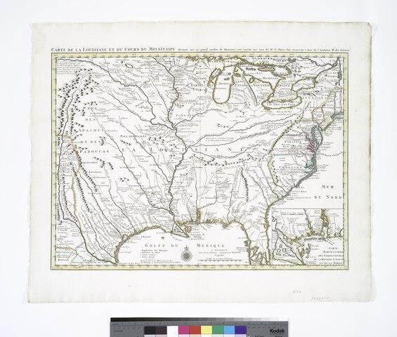
[edit]| Description | Carte de la Louisiane et du cours du Mississipi dressée sur un grand nombre de memoires entr'autres sur ceux de Mr. le Maire, / par Guillme. de L'Isle de l'Academie Rle. des Sciences. | |||||||||||||||||||||||
| Notes | Covers eastern United States from the Atlantic Ocean and Hudson River Valley to the Rio Grande. Note 2.) Includes notes. Note 3.) Inset: Carte particuliere des embouchures de la riviere S. Louis et de la Mobile. Scale [ca. 1:2,700,000]. Note 4.) Lawrence H. Slaughter Collection ; 453 ; 458. Note 5.) National Endowment for the Humanities Grant for Access to Early Maps of the Middle Atlantic Seaboard. Note 6.) Relief shown pictorially. Note 7.) Shows some explorers' routes. Note 8.) Appears in the author's Atlas nouveau, contenant toutes les parties du monde. 1730 and later eds. Note 9.) Appears in the author's Atlas nouveau, contenant toutes les parties du monde. 1730 and later eds. Note 10.) Appears in the author's Atlas nouveau, contenant toutes les parties du monde. 1730 and later eds. Note 11.) Appears in the author's Atlas nouveau, contenant toutes les parties du monde. 1730 and later eds. Note 12.) Appears in the author's Atlas nouveau, contenant toutes les parties du monde. 1730 and later eds. Note 13.) Appears in the author's Atlas nouveau, contenant toutes les parties du monde. 1730 and later eds. Note 14.) Appears in the author's Atlas nouveau, contenant toutes les parties du monde. 1730 and later eds. Note 15.) Appears in the author's Atlas nouveau, contenant toutes les parties du monde. 1730 and later eds. | |||||||||||||||||||||||
| Standard reference | Phillips 3486 [et al.]; Tooley. Mapping of America, p. 22, no. 45; Variant of Wheat, C.I. Mapping the transmississippi West, 99; Cumming 208; Cumming 208; Cumming 208; Cumming 208 | |||||||||||||||||||||||
| Physical description | 1 map : hand col. ; 42 x 58 cm. | |||||||||||||||||||||||
| Catalog Call Number | Map Div. 97-6081 [LHS 453] | |||||||||||||||||||||||
| Date | circa 1730 | |||||||||||||||||||||||
| Source |
http://digitalgallery.nypl.org/nypldigital/dgkeysearchdetail.cfm?imageID=434118
|
|||||||||||||||||||||||
| Author | L'Isle, Guillaume de, 1675-1726 -- CartographerLe Maire, François, b. 1675 -- Author ;Cóvens et Mortier -- Publisher | |||||||||||||||||||||||
| Permission (Reusing this file) |
From The Lionel Pincus & Princess Firyal Map Division. Released on a CC0 license.[1] | |||||||||||||||||||||||
| Digital ID | 434118 | |||||||||||||||||||||||
| Location | Stephen A. Schwarzman Building / The Lionel Pincus and Princess Firyal Map Division | |||||||||||||||||||||||
| NYPL digital item published | 2-26-2005; updated 3-25-2011 | |||||||||||||||||||||||

Licensing
[edit]| This file is made available under the Creative Commons CC0 1.0 Universal Public Domain Dedication. | |
| The person who associated a work with this deed has dedicated the work to the public domain by waiving all of their rights to the work worldwide under copyright law, including all related and neighboring rights, to the extent allowed by law. You can copy, modify, distribute and perform the work, even for commercial purposes, all without asking permission.
|
The making of this file was supported by Wikimedia UK.
To see other files made with the support of Wikimedia UK, please see the category Supported by Wikimedia UK.
|
File history
Click on a date/time to view the file as it appeared at that time.
| Date/Time | Thumbnail | Dimensions | User | Comment | |
|---|---|---|---|---|---|
| current | 09:51, 6 November 2023 |  | 5,475 × 4,654 (72.91 MB) | Sebastian Wallroth (talk | contribs) | Rotated 270° using CropTool with precise mode. |
| 14:49, 15 April 2014 |  | 4,656 × 5,475 (72.94 MB) | Fæ (talk | contribs) | =={{int:filedesc}}== {{NYPL_map |digital_id = 434118 |standard_reference = Phillips 3486 [et al.]; Tooley. Mapping of America, p. 22, no. 45; Variant of Wheat, C.I. Mapping the transmississippi West, 99; Cumming 208; Cumming 208; Cumming 208; Cumming 2... |
You cannot overwrite this file.
File usage on Commons
The following page uses this file: