Category:Wiesent (Upper Palatinate)
Jump to navigation
Jump to search
municipality of Germany    | |||||
| Upload media | |||||
| Instance of |
| ||||
|---|---|---|---|---|---|
| Part of |
| ||||
| Location | Regensburg, Upper Palatinate, Bavaria, Germany | ||||
| Head of government |
| ||||
| Population |
| ||||
| Area |
| ||||
| Elevation above sea level |
| ||||
| Different from | |||||
| official website | |||||
 | |||||
Subcategories
This category has the following 6 subcategories, out of 6 total.
Pages in category "Wiesent (Upper Palatinate)"
This category contains only the following page.
Media in category "Wiesent (Upper Palatinate)"
The following 20 files are in this category, out of 20 total.
-
 DEU Wiesent COA.svg 819 × 891; 91 KB
-
 Wappen Wiesent.png 116 × 144; 18 KB
-
 Burgstall Neuhaus (Wiesent).PNG 741 × 418; 702 KB
-
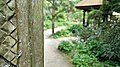
 Einsiedelei, Außenansicht.jpg 3,648 × 2,432; 5.97 MB
-
 Einsiedelei, Gesamtansicht.jpg 3,648 × 2,432; 6.06 MB
-
 Einsiedelei, Innenansicht.jpg 2,432 × 3,648; 3.2 MB
-
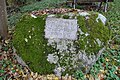
 Gedenkstein 'Peter Wiesner' zwischen Wiesent und Frauenzell (1).jpg 1,536 × 2,048; 780 KB
-
 Gedenkstein für die Einsiedlerklause.jpg 3,648 × 2,432; 5.84 MB
-
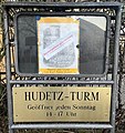 Hudetz-Turm Oeffnungszeiten.jpg 2,715 × 2,884; 1 MB
-
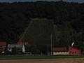
 Nepal Tempel Wiesent - panoramio (1).jpg 4,160 × 2,340; 4.79 MB
-
 Nepal Tempel Wiesent Anlage - panoramio.jpg 4,160 × 2,340; 4.01 MB
-
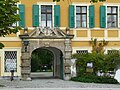
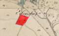 Schloss Ettersdorf (Wiesent).PNG 679 × 420; 516 KB
-
 Vignoble sur le coteau de la vallée du Danube.JPG 2,816 × 2,112; 1.17 MB
-
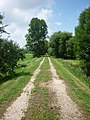 Walhallabahn Bahndamm.JPG 2,736 × 3,648; 4.64 MB
-
 Weinstube in Kruckenberg.JPG 3,648 × 2,736; 5.05 MB
-
 Wiesent - panoramio (1).jpg 2,298 × 3,064; 2.47 MB
-
 Wiesent 30846.jpg 1,600 × 1,200; 890 KB
-
 Wiesent 30847.jpg 1,600 × 1,200; 948 KB
-
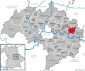 Wiesent in R.svg 829 × 691; 689 KB
-
 Wiesent, R v W.jpg 4,489 × 2,481; 1.1 MB

.PNG)


.jpg)


.jpg)

.PNG)


.jpg)


