Category:Donaustauf
Jump to navigation
Jump to search
market municipality of Germany    | |||||
| Upload media | |||||
| Instance of |
| ||||
|---|---|---|---|---|---|
| Part of |
| ||||
| Location | Regensburg, Upper Palatinate, Bavaria, Germany | ||||
| Population |
| ||||
| Area |
| ||||
| Elevation above sea level |
| ||||
| official website | |||||
 | |||||
Subcategories
This category has the following 8 subcategories, out of 8 total.
Media in category "Donaustauf"
The following 46 files are in this category, out of 46 total.
-
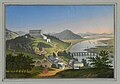
 Aquarell - Donaustauf - Lebschée nach Donauer.jpg 2,000 × 1,475; 338 KB
-
 Bloody-nosed beetle - Tatzenkäfer (Chrysomelidae Trimarcha tenebricosa) (6979054918).jpg 2,325 × 1,744; 2.33 MB
-
 Danube 04850.jpg 4,912 × 3,162; 2.45 MB
-
 DoDo5 - panoramio.jpg 1,280 × 1,024; 496 KB
-
 Donaustauf - panoramio (10).jpg 5,456 × 3,632; 6.01 MB
-
 Donaustauf - panoramio (2).jpg 5,456 × 3,632; 3.84 MB
-
 Donaustauf - panoramio (3).jpg 5,456 × 3,632; 2.04 MB
-
 Donaustauf - panoramio (4).jpg 5,456 × 3,632; 2.36 MB
-
 Donaustauf - panoramio (5).jpg 5,456 × 3,632; 3.14 MB
-
 Donaustauf - panoramio (8).jpg 4,705 × 3,137; 4.52 MB
-
 Donaustauf Chinese Tower 001.jpg 3,024 × 4,032; 4.8 MB
-
 Donaustauf Chinese Tower 002.jpg 3,024 × 4,032; 4.13 MB
-
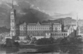
 Donaustauf in 19th century.jpg 1,200 × 719; 822 KB
-
 Donaustauf in R.svg 829 × 691; 689 KB
-
 Donaustauf Markt mit Schloss Burgruine und Walhalla um 1850.png 954 × 599; 685 KB
-
 Donaustauf Marktplatz.jpg 2,592 × 1,458; 2.7 MB
-
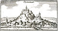 Donaustauf Merian 1644.jpg 1,110 × 600; 523 KB
-
 Donaustauf mit Walhalla und Schloss.jpg 800 × 562; 58 KB
-

-
 DONAUSTAUF nieder.png 480 × 360; 5 KB
-
 DONAUSTAUF nieder.svg 512 × 427; 21 KB
-
-
 Donaustauf, the Maxstraße.JPG 4,272 × 2,848; 3.17 MB
-
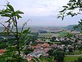
 Donaustauf, view to the village Sulzbach and to the church St. Martin.JPG 4,162 × 2,840; 6.07 MB
-
 Donaustauf.jpg 3,600 × 1,800; 1.92 MB
-
 Feliciano Vargas (Aries) (Hetalia) (8167627617).jpg 2,608 × 3,904; 1.16 MB
-
 Johannes Braungart Donaustauf mit Burgruine und Skizze von Regensburg.jpg 2,000 × 1,489; 1.21 MB
-
 Jäger Nostale (8167662044).jpg 2,592 × 3,888; 4.18 MB
-
 KdKB Stadtamhof 0052.png 1,477 × 1,034; 885 KB
-
 Königreich Bayern - Denkwürdigkeiten und Schönheiten 469.jpg 3,384 × 2,552; 756 KB
-
 Le Tour du monde-07-p151.jpg 1,058 × 702; 387 KB
-
 Lithographie - Donaustauf - Walhalla - um 1850.jpg 1,358 × 954; 266 KB
-
 NosTale (8167660376).jpg 2,592 × 3,888; 4.36 MB
-
 Panoramaaussicht auf der Walhalla - panoramio.jpg 15,309 × 2,771; 6.94 MB
-
 Photo - Donaustauf - Jubiläum 25 Jahre Walhalla-Bockerl - 1914.jpg 2,048 × 1,230; 1,011 KB
-
 Radierung - Donaustauf - Steingrübel um 1825.jpg 1,365 × 1,140; 216 KB
-
 Schloss Donaustauf nach dem Brand 1880.png 791 × 590; 392 KB
-
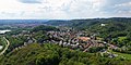
 Teil von donaustauf von oben.jpg 2,592 × 1,944; 1.1 MB
-

-
 The Walhalla, Ratisbon (Regensburg), Bavaria, Germany-LCCN2002696171.jpg 3,644 × 2,727; 2.93 MB
-
 Thonaustauff (Merian).jpg 2,878 × 1,552; 591 KB
-
 Trimarcha tenebricosa (6979052912).jpg 2,524 × 1,893; 2.27 MB
-
 Trimarcha tenebricosa (Chrysomelidae) (7125141467).jpg 2,073 × 1,555; 1.68 MB
-
 Wappen Donaustauf.png 150 × 160; 71 KB
-
 Wappen Donaustauf.svg 575 × 647; 137 KB
-
 Wildhüter NosTale (8167665128).jpg 2,608 × 3,904; 2.02 MB

_(6979054918).jpg)


.jpg)
.jpg)
.jpg)
.jpg)
.jpg)
.jpg)


_(Hetalia)_(8167627617).jpg)

.jpg)


.jpg)


,_Bavaria,_Germany-LCCN2002696172.jpg)
,_Bavaria,_Germany-LCCN2002696171.jpg)
.jpg)
.jpg)
_(7125141467).jpg)

.jpg)