Category:Utah State Route 114
Jump to navigation
Jump to search
 | number: | (one hundred fourteen) |
|---|---|---|
| State highways in Utah: | 94 · 95 · 96 · 97 · 98 · 99 · 100 · 101 · 102 · 103 · 104 · 105 · 106 · 107 · 108 · 109 · 110 · 111 · 112 · 113 · 114 · 115 · 116 · 117 · 118 · 119 · 120 · 121 · 122 · 123 · 124 · 125 · 126 · 127 · 128 · 129 · 130 · 131 · 132 · 133 · 134 |
state highway in Utah County, Utah, United States  | |||||
| Upload media | |||||
| Instance of | |||||
|---|---|---|---|---|---|
| Location | Utah County, Utah | ||||
| Transport network | |||||
| Connects with | |||||
| Owned by | |||||
| Maintained by | |||||
| Inception |
| ||||
| Length |
| ||||
| Terminus | |||||
| |||||
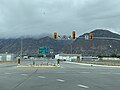
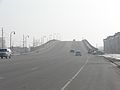
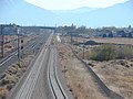
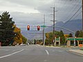
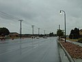
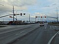
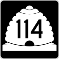
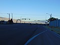
English: Media related to Utah State Route 114, a 10.787-mile (17.360 km) state highway in northwestern Utah County, Utah, United States, that connects U.S. Route 89 (500 East) at the western end of Downtown Provo with U.S. Route 89 (State Street) in Pleasant Grove (forming a western loop off U.S. Route 89), with a connection with Interstate 15 in western Provo along the way. The majority of the highway is also known as Geneva Road, but also includes part of West Center Street in Provo and part of South Main Street in Pleasant Grove.
Subcategories
This category has only the following subcategory.
Media in category "Utah State Route 114"
The following 42 files are in this category, out of 42 total.
-
 114 bridge (44303590555).jpg 4,032 × 3,024; 1.79 MB
-
 114 southbound (45214569441).jpg 4,032 × 3,024; 1.77 MB
-
 East across SR-114 & SR-265 junction, Feb 16.jpg 2,816 × 2,112; 1.95 MB
-
 East at I-15 & SR-114 interchange, Provo, Utah, May 16.jpg 2,592 × 1,944; 2.33 MB
-
 East at Junction SR-52. SR-114, and SR-176, Feb 16.jpg 2,816 × 2,112; 1.96 MB
-
 East at SR-114 & W 800 S intersection in Orem, Utah, Jun 16.jpg 2,592 × 1,944; 2.32 MB
-
 East at SR-241 & SR-114 junction in Utah County, Utah, Jun 16.jpg 2,592 × 1,944; 2.37 MB
-
 East on Center St at Geneva Rd, Provo, Utah, Oct 16.jpg 2,592 × 1,944; 2.4 MB
-
 East on SR-114, from under 1-15, in Provo, Utah.jpg 4,032 × 3,024; 1.59 MB
-
 Eastbound 114 (45214569231).jpg 4,032 × 3,024; 2.94 MB
-
 Geneva road (43401785270).jpg 3,027 × 2,270; 1.19 MB
-
 I-15, SR 114 (44303590125).jpg 4,032 × 3,024; 1.33 MB
-
 Looking south at railroad viaduct on SR-114, Feb 16.jpg 2,816 × 2,112; 2.31 MB
-
 Looking south from Vineyard station, bird's eye view.JPG 2,816 × 2,112; 2.62 MB
-
 Looking southeast on southbound I-15 ramp, Provo, Utah, May 16.jpg 2,592 × 1,944; 2.33 MB
-
 North at SR-114 & W 800 S intersection in Orem, Utah, Jun 16.jpg 2,592 × 1,944; 2.35 MB
-
 North at SR-129 & SR-114 Junction, Lindon, Utah, Jun 16.jpg 2,592 × 1,944; 2.39 MB
-
 North at SR-241 & SR-114 junction in Utah County, Utah, Jun 16.jpg 2,592 × 1,944; 2.35 MB
-
 North on S 2050 W at Center St, Provo, Utah, Oct 16.jpg 2,592 × 1,944; 2.34 MB
-
 Northeast at SR-114 & W 400 S in Orem, Utah, Jun 16.jpg 2,592 × 1,944; 2.39 MB
-
 Signs on 114 at 15 (45214569071).jpg 4,032 × 3,024; 1.88 MB
-
 South 114 (44492983514).jpg 4,032 × 3,024; 1.42 MB
-
 South at SR-114 & W 400 S in Orem, Utah, Jun 16.jpg 2,592 × 1,944; 2.4 MB
-
 South at SR-114 & W 800 S intersection in Orem, Utah, Jun 16.jpg 2,592 × 1,944; 2.33 MB
-
 South at SR-129 & SR-114 Junction, Lindon, Utah, Jun 16.jpg 2,592 × 1,944; 2.26 MB
-
 South at SR-241 & SR-114 junction in Utah County, Utah, Jun 16.jpg 2,592 × 1,944; 2.36 MB
-
 South on Geneva Rd at Center St, Provo, Utah, Oct 16.jpg 2,592 × 1,944; 2.42 MB
-
 Southeast at FrontRunner tracks under Geneva Road, Mar 16.jpg 2,592 × 1,944; 2.38 MB
-
 SR 114 (31340806138).jpg 3,271 × 2,453; 1.62 MB
-
 SR 114 APL (30275856867).jpg 4,032 × 3,024; 1.34 MB
-
 SR 114, I-15 APL (30275857647).jpg 4,032 × 3,024; 1.25 MB
-
 Towards provo (30275857127).jpg 4,032 × 3,024; 1.66 MB
-
 Utah 114.svg 750 × 600; 72 KB
-
 Utah SR 114.svg 385 × 385; 6 KB
-
 West at Junction SR-52. SR-114, and SR-176, Feb 16.jpg 2,816 × 2,112; 2.1 MB
-
 West at SR-114 & W 400 S in Orem, Utah, Jun 16.jpg 2,592 × 1,944; 2.34 MB
-
 West at SR-114 & W 800 S intersection in Orem, Utah, Jun 16.jpg 2,592 × 1,944; 2.35 MB
-
 West at SR-114, W Center St, & E Mill Road in Vineyard, Utah, Jun 16.jpg 2,592 × 1,944; 2.33 MB
-
 West at SR-129 & SR-114 Junction, Lindon, Utah, Jun 16.jpg 2,592 × 1,944; 2.21 MB
-
 West at SR-241 & SR-114 junction in Utah County, Utah, Jun 16.jpg 2,592 × 1,944; 2.33 MB
-
 West on Center St at Geneva Rd, Provo, Utah, Oct 16.jpg 2,592 × 1,944; 2.35 MB
-
 West on SR-114 at I-15, May 16.jpg 2,592 × 1,944; 2.33 MB
.jpg)
.jpg)


.jpg)
.jpg)
.jpg)


.jpg)
.jpg)


.jpg)
.jpg)
.jpg)
.jpg)


