Category:Twechar
Jump to navigation
Jump to search
village in East Dunbartonshire, Scotland, UK .jpg) .jpg) | |||||
| Upload media | |||||
| Instance of | |||||
|---|---|---|---|---|---|
| Location |
| ||||
| Population |
| ||||
 | |||||
Subcategories
This category has the following 4 subcategories, out of 4 total.
Media in category "Twechar"
The following 60 files are in this category, out of 60 total.
-
 A wet bit of a field - geograph.org.uk - 2745459.jpg 640 × 480; 239 KB
-
 Baling silage - geograph.org.uk - 3293836.jpg 640 × 480; 92 KB
-
 Bar Hill from the air (geograph 4517293).jpg 640 × 480; 144 KB
-
 Bar Hill from the northwest - geograph.org.uk - 2153287.jpg 640 × 480; 161 KB
-
 Bar Hill water tank, Twechar, East Dunbartonshire.jpg 1,920 × 1,080; 1.14 MB
-
 Barrhill Tavern, Twechar - geograph.org.uk - 131390.jpg 640 × 431; 82 KB
-
 Board Burn flowing through aqueduct. - geograph.org.uk - 1896693.jpg 800 × 600; 223 KB
-

-
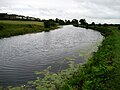
 Canal at Twechar - geograph.org.uk - 422564.jpg 640 × 480; 91 KB
-
 Canal boat - geograph.org.uk - 953963.jpg 640 × 480; 92 KB
-
 Canal bridge at Twechar - geograph.org.uk - 6369321.jpg 1,024 × 768; 253 KB
-
 Canal towpath near Twechar - geograph.org.uk - 6117867.jpg 3,648 × 2,736; 1.93 MB
-
 Closed bridge at Twechar - geograph.org.uk - 5952116.jpg 3,776 × 2,520; 3.32 MB
-
 Darainage ditch, Twechar - geograph.org.uk - 1961899.jpg 768 × 1,024; 190 KB
-
 East Lodge to Wester Gartshore - geograph.org.uk - 128812.jpg 640 × 449; 83 KB
-
 Eastern gateway to Wester Gartshore - geograph.org.uk - 128415.jpg 640 × 464; 338 KB
-
 Easterton Moss - geograph.org.uk - 1961924.jpg 800 × 600; 92 KB
-
 Entrance to Heritage Path - geograph.org.uk - 3133481.jpg 1,024 × 768; 360 KB
-
 Field of ripening barley - geograph.org.uk - 1961912.jpg 800 × 600; 132 KB
-
 Field to west of Bar Hill - geograph.org.uk - 4514048.jpg 3,504 × 2,336; 3.94 MB
-
 Field work for trainee trig point spotter - geograph.org.uk - 2747921.jpg 1,024 × 709; 140 KB
-
 Forth and Clyde Canal - geograph.org.uk - 1547066.jpg 640 × 480; 90 KB
-
 Forth and Clyde Canal - geograph.org.uk - 6369323.jpg 1,024 × 768; 227 KB
-
 Forth and Clyde canal - geograph.org.uk - 87780.jpg 640 × 478; 75 KB
-
 Forth and Clyde Canal at Twechar - geograph.org.uk - 1459446.jpg 640 × 480; 78 KB
-
 Forth and Clyde Canal, Twechar - geograph.org.uk - 5671728.jpg 3,968 × 2,976; 2.91 MB
-
 Frozen Forth Clyde Canal near Twechar - geograph.org.uk - 131384.jpg 640 × 480; 105 KB
-
 House on the B8048 - geograph.org.uk - 2736205.jpg 640 × 480; 114 KB
-
 Lines over the barley - geograph.org.uk - 1961932.jpg 800 × 600; 90 KB
-
 Looking West from Bar Hill - geograph.org.uk - 1843573.jpg 820 × 615; 71 KB
-
 Low lying grassland - geograph.org.uk - 2745532.jpg 640 × 480; 236 KB
-
 Marshy corner of field at West Board - geograph.org.uk - 1858921.jpg 800 × 600; 95 KB
-
 Minor road from Queenzieburn to Twechar - geograph.org.uk - 4882468.jpg 1,600 × 1,200; 423 KB
-
 Plantation of broad leaf - geograph.org.uk - 1961920.jpg 800 × 600; 119 KB
-
 Pond and field near Easterton - geograph.org.uk - 5345021.jpg 640 × 419; 39 KB
-
 Reflections in the canal - geograph.org.uk - 900420.jpg 640 × 480; 128 KB
-
 Ruined steading - geograph.org.uk - 3292324.jpg 640 × 480; 94 KB
-
 Shirva Pend (geograph 2288210).jpg 1,024 × 685; 264 KB
-
 The end of the River Kelvin Walkway - geograph.org.uk - 5952112.jpg 3,776 × 2,520; 3.99 MB
-
 The Kelvin by Twechar - geograph.org.uk - 128426.jpg 640 × 480; 274 KB
-
 The Kelvin flood plain - geograph.org.uk - 1962685.jpg 800 × 529; 108 KB
-
 The River Kelvin at Twechar - geograph.org.uk - 2153293.jpg 640 × 480; 141 KB
-
 The River Kelvin, Dumbreck Marsh - geograph.org.uk - 1705452.jpg 1,024 × 768; 800 KB
-

-
 Twechar - geograph.org.uk - 1459437.jpg 640 × 480; 63 KB
-
 Twechar - geograph.org.uk - 87783.jpg 640 × 480; 165 KB
-
 Twechar from the air (geograph 4517301).jpg 640 × 480; 133 KB
-
 Twechar from the air (geograph 5308166).jpg 480 × 640; 148 KB
-
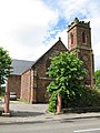 Twechar Parish Church (geograph 3036627).jpg 480 × 640; 80 KB
-
 Twechar Stables - geograph.org.uk - 422560.jpg 640 × 480; 163 KB
-
 Twechar War Memorial - geograph.org.uk - 3036621.jpg 640 × 480; 105 KB
-
 Twechar War Memorial - geograph.org.uk - 422568.jpg 640 × 480; 126 KB
-
 Various road signs - geograph.org.uk - 2153285.jpg 640 × 480; 157 KB
-
 View from Castle Hill and trig point - geograph.org.uk - 2748968.jpg 1,024 × 681; 89 KB
-
 View looking south from bridge - geograph.org.uk - 49327.jpg 600 × 462; 193 KB
-
 View north-west from Bar Hill, Twechar, East Dunbartonshire.jpg 1,920 × 972; 367 KB
-
 Water treatment plant above Twechar - geograph.org.uk - 2782258.jpg 640 × 480; 86 KB
-
 West Board Farm - geograph.org.uk - 2580381.jpg 640 × 480; 91 KB
-
 Wester Gartshore East Lodge - geograph.org.uk - 3036692.jpg 640 × 480; 116 KB
-
 Wester Shirva - geograph.org.uk - 2153283.jpg 640 × 480; 151 KB


.jpg)


.jpg)


.jpg)


