Category:Streets in Ruhland
Jump to navigation
Jump to search
| Object location | | View all coordinates using: OpenStreetMap |
|---|
Straßen in Ruhland[edit]
Deutsch: Diese Kategorie erfasst Straßen und ausgewählte Wirtschaftswege in Ruhland mit Ortsteil Arnsdorf.
Straßen, Gäßchen, Plätze und weitere öffentlich genutzte Flächen sind in der Liste der Straßen und Plätze in Ruhland.
Straßen, Gäßchen, Plätze und weitere öffentlich genutzte Flächen sind in der Liste der Straßen und Plätze in Ruhland.
Subcategories
This category has the following 8 subcategories, out of 8 total.
Pages in category "Streets in Ruhland"
The following 64 pages are in this category, out of 64 total.
A
B
F
G
H
K
Media in category "Streets in Ruhland"
The following 200 files are in this category, out of 711 total.
(previous page) (next page)-
 02 Anatoli Riaboshenko Ruhland Berliner Str.-innen 40x50 Öl-Lw 2017.jpg 2,573 × 1,989; 2.02 MB
-
 06 Anatoli Riaboshenko Ruhland Wallstraße 40x50 Öl-Lw 2017.jpg 2,433 × 1,894; 997 KB
-
 11 Anatoli Riaboshenko Ruhland Berliner Str.-außen 40x50 Öl-Lw 2017.jpg 2,454 × 1,936; 1.87 MB
-
 14 Anatoli Riaboshenko Ruhland Schützenhaus 40x50 Öl-Lw 2017.jpg 2,496 × 1,991; 888 KB
-
 15 Anatoli Riaboshenko Ruhland Miletas Gaststätte 40x50 Öl-Lw 2017.jpg 2,417 × 1,970; 1.97 MB
-
 20924-Ruhland-1918-Berliner Straße-Brück & Sohn Kunstverlag.jpg 1,524 × 1,000; 548 KB
-
 Geschwister-Scholl-Weg Ruhland Birkenweg ostwärts 1.jpg 1,200 × 1,600; 1.2 MB
-
 Geschwister-Scholl-Weg Ruhland, Birkenweg ostwärts 2.jpg 1,704 × 2,272; 719 KB
-
 Geschwister-Scholl-Weg Ruhland, Birkenweg ostwärts 3.jpg 1,704 × 2,272; 615 KB
-
 Geschwister-Scholl-Weg Ruhland, Birkenweg westwärts 1.jpg 1,704 × 2,272; 467 KB
-
 Geschwister-Scholl-Weg Ruhland, Birkenweg westwärts 2.jpg 1,704 × 2,272; 739 KB
-
 Geschwister-Scholl-Weg Ruhland, Birkenweg westwärts 3.jpg 1,704 × 2,272; 732 KB
-
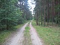
 Radweg Arnsdorf-Guteborn ostwärts bei Waldesruh, Spätfrühling, 01.jpg 2,272 × 1,704; 683 KB
-
 Radweg Arnsdorf-Guteborn ostwärts bei Waldesruh, Spätfrühling, 02.jpg 2,272 × 1,704; 594 KB
-
 Ruhlad, Parkstr. ostwärts bei Hausnr. 11, Frühling, 01.jpg 1,600 × 1,200; 1.22 MB
-

-

-

-
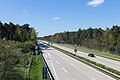 Ruhland, A 13 Nordnordostansicht von der Überführung Ortrander Str., 01.jpg 1,600 × 1,067; 491 KB
-
 Ruhland, Alte Hermsdorfer Str. 1, Margeriten blühend am Rand, Frühsommer, 03.jpg 3,000 × 4,000; 6.7 MB
-
 Ruhland, Alte Hermsdorfer Str. vom Knick ostnordostwärts, Sommer, 01.jpg 3,648 × 2,736; 6.39 MB
-
 Ruhland, Alte Hermsdorfer Str. von der Kreuzung Hermsdorfer - Wiesenstr., Sommer, 01.jpg 3,648 × 2,736; 4.81 MB
-
 Ruhland, Alte Hermsdorfer Str. von der Kreuzung Hermsdorfer - Wiesenstr., Sommer, 02.jpg 3,648 × 2,736; 5.69 MB
-
 Ruhland, Alte Hermsdorfer Str. über Kreuzung Hermsdorfer in die Wiesenstr., Sommer, 01.jpg 3,648 × 2,736; 7.41 MB
-
 Ruhland, Alte Hermsdorfer Str., von der Wiesenstr. westnordwestwärts.jpg 2,272 × 1,704; 341 KB
-
 Ruhland, Alte Hermsdorfer Str., Westansicht am Knick.jpg 2,272 × 1,704; 550 KB
-
 Ruhland, Alte Hermsdorfer Str., Westsüdwestansicht von der Kreuzung Kamenzer Str.jpg 2,272 × 1,704; 427 KB
-
 Ruhland, Alte Poststraße nordostwärts hinter der Bahnbrücke, Herbst, 01.jpg 3,264 × 2,448; 3.94 MB
-
 Ruhland, Alte Poststraße nordostwärts hinter der Bahnbrücke, Herbst, 02.jpg 4,000 × 3,000; 5.72 MB
-
 Ruhland, Alte Poststraße südostwärts vor der Bahnbrücke, Herbst, 01.jpg 4,000 × 3,000; 4.94 MB
-
 Ruhland, Alte Poststraße südwestwärts vor der Bahnbrücke, Herbst, 01.jpg 4,000 × 3,000; 5.97 MB
-
 Ruhland, Alte Poststraße südwestwärts vor der Bahnbrücke, Herbst, 02.jpg 3,264 × 2,448; 2.35 MB
-
 Ruhland, Alte Waldstraße am westlichen Waldrand, Blick nach Osten.jpg 1,600 × 1,200; 1.35 MB
-
 Ruhland, alte Waldstraße auf dem Weg zur Furt, Blick nach Osten.jpg 1,600 × 1,200; 1.3 MB
-
 Ruhland, Alte Waldstraße bei den Buschwiesen, Blick nach Nordwest, Frühsommer.jpg 1,600 × 1,200; 1.38 MB
-
 Ruhland, Alte Waldstraße hinter den Buschwiesen, Blick nach Nordwest, Frühsommer.jpg 1,600 × 1,200; 1.3 MB
-
 Ruhland, Alte Waldstraße, Blick auf die Sieggraben-Furt nach Westen, Frühsommer.jpg 1,600 × 1,200; 1.31 MB
-
 Ruhland, alte Waldstraße, Blick nach Westen Richtung Sieggraben-Furt.jpg 1,600 × 1,200; 1.23 MB
-
 Ruhland, alte „Poststraße“ (nach Ortrand), Ostansicht beim Forsthaus.jpg 2,272 × 1,704; 585 KB
-
 Ruhland, alte „Poststraße“ (nach Ortrand), Westansicht aus Richtung Sieggraben.jpg 2,272 × 1,704; 630 KB
-
 Ruhland, alte „Poststraße“ (nach Ortrand), Westansicht beim Forsthaus zum Sieggraben.jpg 2,272 × 1,704; 491 KB
-
 Ruhland, alte „Poststraße“ (nach Ortrand), Westansicht zum Forsthaus und Sieggraben.jpg 2,272 × 1,704; 527 KB
-
 Ruhland, alte „Poststraße“ (nach Ortrand), Westansicht zum Sieggraben.jpg 2,272 × 1,704; 527 KB
-

-
 Ruhland, Am Anger, Westsüdwestansicht von Nr. 1.jpg 2,272 × 1,704; 534 KB
-
 Ruhland, Am Anger, Westsüdwestansicht von Nr. 4.jpg 2,272 × 1,704; 600 KB
-
 Ruhland, Am Bach (Straße) Ecke Fischerstr., Grauerle, blühend, Vorfrühling, 01.jpg 2,736 × 3,648; 1.62 MB
-

-
 Ruhland, Am Bach (Straße) nordwärts bei Hausnr. 1, Frühling, 01.jpg 2,736 × 3,316; 1.42 MB
-

-
 Ruhland, Am Bach (Straße) nordwärts von Gutshof (Straße), Frühling, 01.jpg 3,648 × 2,736; 4.36 MB
-
 Ruhland, Am Bach (Straße) nordwärts zwischen Hausnr. 1–2, Frühling, 01.jpg 3,194 × 2,647; 1.11 MB
-
 Ruhland, Am Bach (Straße) nordwärts zwischen Hausnr. 1–2, Frühling, 02.jpg 3,648 × 2,736; 3.43 MB
-
 Ruhland, Am Bach (Straße) nordwärts zwischen Hausnr. 1–2, Frühling, 03.jpg 3,648 × 2,736; 3.85 MB
-

-
 Ruhland, Am Bach (Straße), Blick von Norden.jpg 2,272 × 1,704; 665 KB
-
 Ruhland, Am Bach (Straße), Blick von Nr. 2 nach Süden.jpg 1,704 × 2,272; 679 KB
-
 Ruhland, Am Bach (Straße), Südansicht von Gutshof (Straße).jpg 2,272 × 1,704; 815 KB
-
 Ruhland, Am Bach bei Fischerstr. 45, Südansicht, Winter, 01.jpg 2,272 × 1,704; 459 KB
-
 Ruhland, Am Bach bei Fischerstr. 45, Südansicht, Winter, 02.jpg 2,272 × 1,704; 614 KB
-
 Ruhland, Am Bach bei Fischerstr. 45, Südansicht, Winter, 03.jpg 2,272 × 1,704; 623 KB
-
 Ruhland, Am Bach bei Haiusnr. 2, Südwestansicht, Winter.jpg 2,272 × 1,704; 613 KB
-
 Ruhland, Am Bach bei Hausnr. 2, Schwarzwasser, Nordansicht, Winter.jpg 2,272 × 1,704; 602 KB
-
 Ruhland, Am Bach, bei Hausnr. 2 südwärts, Winter.jpg 2,272 × 1,704; 515 KB
-
 Ruhland, Am Bach, Brücke bei Fischerstr. 45, Nordansicht, Winter.jpg 2,272 × 1,704; 664 KB
-
 Ruhland, Am Bach, Brücke bei Haiusnr. 2, Südansicht, Winter.jpg 2,272 × 1,704; 664 KB
-
 Ruhland, Am Bach, Brücke bei Hausnr. 2, Ostansicht, Winter.jpg 2,272 × 1,704; 504 KB
-
 Ruhland, Am Dreistein, Nordostende 01.jpg 1,200 × 1,068; 201 KB
-
 Ruhland, Am Dreistein, Nordostende 02.jpg 1,600 × 1,200; 999 KB
-
 Ruhland, Am Dreistein, Nordwestende 01.jpg 1,462 × 1,200; 317 KB
-
 Ruhland, Am Dreistein, Nordwestende 02.jpg 1,447 × 985; 210 KB
-
 Ruhland, Am Dürrbachgraben (Straße), Blick von Süden.jpg 2,272 × 1,704; 501 KB
-
 Ruhland, Am Fließ, Nordostansicht bei Am Lug.jpg 2,272 × 1,704; 514 KB
-
 Ruhland, Am Fließ, Südsüdwestansicht bei Am Lug.jpg 2,272 × 1,704; 806 KB
-
 Ruhland, Am Lug nordostwärts bei Hausnr. 1, Sommer, 01.jpg 3,648 × 2,736; 3.44 MB
-
 Ruhland, Am Lug nordwestwärts bei Hausnr. 1, Sommer, 01.jpg 3,648 × 2,736; 3.57 MB
-
 Ruhland, Am Lug nordwestwärts bei Hausnr. 1, Sommer, 02.jpg 3,648 × 2,736; 5.7 MB
-
 Ruhland, Am Lug nordwärts bei Hausnr. 1, Sommer, 01.jpg 2,736 × 3,648; 3.91 MB
-
 Ruhland, Am Lug südwärts bei Hausnr. 3, Sommer, 01.jpg 3,648 × 2,736; 6.76 MB
-
 Ruhland, Am Lug südwärts bei Hausnr. 3, Sommer, 02.jpg 2,641 × 1,769; 3.27 MB
-
 Ruhland, Am Lug, Blick aus dem Lug-Gäßchen nordwärts, Sommer, 01.jpg 3,648 × 2,736; 3.5 MB
-
 Ruhland, Am Lug, Westsüdwestansicht von Am Anger.jpg 2,272 × 1,704; 511 KB
-
-

-

-
 Ruhland, Am Wiesengrund nordwärts bei Am Lug 3, Sommer, 01.jpg 3,648 × 2,736; 3.57 MB
-
 Ruhland, Am Wiesengrund nordwärts bei Hausnr. 11, Spätfrühling, 01.jpg 3,648 × 2,736; 2.28 MB
-
 Ruhland, Am Wiesengrund nordwärts bei Hausnr. 2, Sommer, 01.jpg 3,648 × 2,736; 7.12 MB
-
 Ruhland, Am Wiesengrund nordwärts bei Hausnr. 4, Sommer, 01.jpg 3,648 × 2,736; 6.48 MB
-
 Ruhland, Am Wiesengrund ostnordostwärts bei Hausnr. 2, Sommer, 01.jpg 3,648 × 2,736; 2.87 MB
-
 Ruhland, Am Wiesengrund südwärts bei Hausnr. 10, Spätfrühling, 01.jpg 3,648 × 2,736; 4.88 MB
-
 Ruhland, Am Wiesengrund, von der Theodor-Schmidt-Str. (Nordnordwestansicht).jpg 2,272 × 1,704; 439 KB
-
 Ruhland, Am Wiesengrund, Westsüdwestabzweig.jpg 2,272 × 1,704; 545 KB
-

-

-
 Ruhland, Anglerweg, Nordnordostansicht von der Zufahrt zu Nr. 7.jpg 2,272 × 1,704; 395 KB
-
 Ruhland, Anglerweg, Ostsüdostansicht von der Zufahrt zu Nr. 7.jpg 2,272 × 1,704; 437 KB
-
 Ruhland, Anglerweg, Westansicht von Badeanstalt (Straße).jpg 2,272 × 1,704; 483 KB
-
 Ruhland, August-Bebel-Str. 01.jpg 2,272 × 1,704; 574 KB
-
 Ruhland, August-Bebel-Str. 02.jpg 1,600 × 1,200; 972 KB
-
 Ruhland, August-Bebel-Str. 03.jpg 1,600 × 1,200; 925 KB
-
 Ruhland, August-Bebel-Str. 04.jpg 1,600 × 1,200; 1,003 KB
-
 Ruhland, August-Bebel-Str. 22a, Südwestansicht, Herbst.jpg 2,272 × 1,704; 481 KB
-
 Ruhland, August-Bebel-Str. bei Hausnr. 1a, Westsüdwestansicht, Herbst, 01.jpg 2,272 × 1,704; 386 KB
-
 Ruhland, Badeanstalt (Straße) bei der dreistämmigen Eiche, Blick ostwärts.jpg 2,272 × 1,704; 742 KB
-
 Ruhland, Badeanstalt (Straße) bei der dreistämmigen Eiche, Blick westsüdwestwärts.jpg 2,272 × 1,704; 677 KB
-
 Ruhland, Badeanstalt (Straße) bei Nr. 7, Blick ostwärts.jpg 2,272 × 1,704; 625 KB
-
 Ruhland, Badeanstalt (Straße) bei Nr. 7, Blick westwärts.jpg 2,272 × 1,704; 429 KB
-
 Ruhland, Badeanstalt (Straße), Ostansicht aus Richtung Schwarzbach.jpg 2,272 × 1,704; 393 KB
-
-
 Ruhland, Badeanstalt (Straße), vom Anglerweg nordostwärts.jpg 2,272 × 1,704; 554 KB
-
 Ruhland, Bergstr. bei Hausnr. 1, Ostsüdostansicht von der Feldstr.jpg 2,272 × 1,704; 469 KB
-
 Ruhland, Bergstr. bei Hausnr. 2 und 5, Ostansicht, 02.jpg 1,704 × 2,272; 362 KB
-
 Ruhland, Bergstr. bei Hausnr. 2+5, Ostansicht, 01.jpg 1,704 × 2,272; 316 KB
-
 Ruhland, Bergstr. bei Hausnr. 6, Ostsüdostansicht.jpg 2,272 × 1,704; 457 KB
-
 Ruhland, Bergstr., bei Hausnr. 2+5, Südsüdostansicht.jpg 1,704 × 2,272; 350 KB
-
 Ruhland, Bergstr., Ostansicht von der Feldstr.jpg 2,272 × 1,704; 561 KB
-
 Ruhland, Bergstr., Ostansicht vor Hospitalstr.jpg 1,704 × 2,272; 255 KB
-
 Ruhland, Bergstr., Westansicht von der Hospitalstr.jpg 2,272 × 1,704; 428 KB
-
 Ruhland, Berliner Str. 20, Abzweig zu Hinter dem Markt, 01.jpg 1,704 × 2,272; 461 KB
-
 Ruhland, Berliner Str. 20, Abzweig zu Hinter dem Markt, 02.jpg 2,272 × 1,704; 442 KB
-
 Ruhland, Berliner Str. 20, Hofeinfahrt, Sommer.jpg 3,000 × 4,000; 2.06 MB
-
 Ruhland, Berliner Str. 20, Südostansicht, 01.jpg 2,272 × 1,704; 427 KB
-
 Ruhland, Berliner Str. 21, 01.jpg 2,272 × 1,704; 384 KB
-
 Ruhland, Berliner Str. ostwärts bei Markt 6, 01.jpg 2,592 × 3,672; 5.65 MB
-
 Ruhland, Berliner Str. stadtauswärts, Willkommensschild, 01.jpg 4,000 × 3,000; 4.64 MB
-
 Ruhland, Berliner Str. stadteinwärts, Willkommensschild, 01.jpg 3,000 × 4,000; 1.45 MB
-
 Ruhland, Berliner Str. stadteinwärts, Willkommensschild, 02.jpg 4,000 × 3,000; 3.8 MB
-
 Ruhland, Berliner Str. südwärts bei Hausnr. 19, 01.jpg 2,272 × 1,704; 365 KB
-
 Ruhland, Berliner Str. Westabzweig, Westansicht, 01.jpg 2,272 × 1,704; 619 KB
-
 Ruhland, Berliner Str. Westabzweig, Westansicht, 02.jpg 2,272 × 1,704; 468 KB
-
 Ruhland, Berliner Str. Westabzweig, Westansicht, 03.jpg 2,272 × 1,704; 411 KB
-
 Ruhland, Berliner Str., L55-Brücke über die Schwarze Elster.jpg 1,600 × 1,067; 581 KB
-
 Ruhland, Berliner Str., Nordnordostansicht bei Hausnr. 11-12.jpg 2,272 × 1,704; 399 KB
-
 Ruhland, Berliner Str., Willkommensschild, 01.jpg 1,600 × 1,200; 1,009 KB
-
 Ruhland, Berliner Str., Willkommensschild, 02.jpg 1,600 × 1,200; 710 KB
-
 Ruhland, Berliner Str., Willkommensschild, 03.jpg 1,600 × 1,200; 767 KB
-
 Ruhland, Berliner Str., Willkommensschild, 04.jpg 1,600 × 1,200; 647 KB
-
 Ruhland, Berliner Straße Westabzweig, Südostansicht 01.jpg 2,272 × 1,704; 424 KB
-
 Ruhland, Berliner Straße Westabzweig, Südostansicht 02.jpg 2,272 × 1,704; 426 KB
-
 Ruhland, Berliner Straße, Nordansicht bei Hausnr. 28, 01.jpg 1,600 × 1,067; 637 KB
-
 Ruhland, Berliner Straße, Nordansicht vom Elsterdamm gegenüber Zollhaus.jpg 2,272 × 1,704; 375 KB
-
 Ruhland, Berliner Straße, Nordnordostansicht beim Zollhaus, 01.jpg 1,600 × 1,067; 678 KB
-
 Ruhland, Berliner Straße, Südansicht vom Elsterbogen bei der Kreuzung.jpg 2,272 × 1,704; 533 KB
-
 Ruhland, Bernsdorfer Str. bei Mündung Querstr., Südostansicht, Baustelle.jpg 2,272 × 1,704; 540 KB
-
 Ruhland, Bernsdorfer Str. bei Mündung Schwarzbacher Weg, Südostansicht, Baustelle.jpg 2,272 × 1,704; 493 KB
-
 Ruhland, Bernsdorfer Str. bei Nr. 9, Ostsüdostansicht.jpg 2,272 × 1,704; 406 KB
-
 Ruhland, Bernsdorfer Str. ostwärts bei Hausnr. 3, Vorwinter, 01.jpg 2,736 × 3,648; 6.01 MB
-

-
 Ruhland, Bernsdorfer Str. südostwärts bei Hausnr. 3, Vorwinter, 01.jpg 2,736 × 3,648; 6.01 MB
-
 Ruhland, Bernsdorfer Str., Südostansicht vor Mündung Nordstr., Baustelle.jpg 2,272 × 1,704; 692 KB
-
 Ruhland, Birkenweg ostwärts bei Rosa-Luxemburg-Str. 18, Colorado-Tanne, Frühling, 01.jpg 2,736 × 3,648; 1.82 MB
-
 Ruhland, Birkenweg ostwärts bei Rosa-Luxemburg-Str. 18, Colorado-Tanne, Frühling, 02.jpg 3,648 × 2,736; 1.74 MB
-
 Ruhland, Birkenweg ostwärts bei Rosa-Luxemburg-Str. 18, Colorado-Tanne, Frühling, 03.jpg 3,563 × 2,670; 6.46 MB
-
 Ruhland, Birkenweg ostwärts nach Rosa-Luxemburg-Str., Herbst, 01.jpg 1,704 × 2,272; 909 KB
-

-

-
 Ruhland, Birkenweg ostwärts vor Neugrabenweg, Herbst, 01.jpg 1,704 × 2,272; 696 KB
-

-
 Ruhland, Birkenweg westwärts vor Rosa-Luxemburg-Str. 18, Herbst, 01.jpg 3,648 × 2,736; 3.54 MB
-
 Ruhland, Birkenweg, Gemeine Fichte zwischen Hausnr. 1 + 3, Südostansicht, Frühling, 01.jpg 3,648 × 2,736; 5.71 MB
-
 Ruhland, Birkenweg, von der Fichtestr. zum Wasserwerk.jpg 2,272 × 1,704; 797 KB
-
 Ruhland, Brauhausgasse von Kreuzung Marienstr., Winter, 01.jpg 2,272 × 1,704; 526 KB
-

-

-
 Ruhland, Brauhausgasse, bei Kreuzung Marienstr. nordwärts, Blick zum Kirchturm.jpg 1,704 × 2,272; 715 KB
-
 Ruhland, Brauhausgasse, Blick zum Brauhausplatz 01.jpg 2,272 × 1,704; 434 KB
-

-
 Ruhland, Brauhausplatz Ostseite, Blick zur Brauhausgasse, Winter, 04.jpg 2,272 × 1,704; 376 KB
-
 Ruhland, Dorfaue (OT Arnsdorf) 01.jpg 2,272 × 1,704; 424 KB
-
 Ruhland, Dorfaue (OT Arnsdorf) 02.jpg 2,272 × 1,704; 525 KB
-
 Ruhland, Dorfaue (OT Arnsdorf) 03.jpg 2,272 × 1,704; 504 KB
-
 Ruhland, Dorfaue (OT Arnsdorf) 04.jpg 2,272 × 1,704; 516 KB
-
 Ruhland, Dorfaue (OT Arnsdorf) nordwärts bei Hausnr. 5, Herbst, 01.jpg 4,000 × 3,000; 4.86 MB
-
 Ruhland, Dr.-Otto-Werkmeister-Str. nordwärts beim Seniorenheim, Bauphase, 01.jpg 2,272 × 1,704; 577 KB
-
 Ruhland, Dr.-Otto-Werkmeister-Str. ostwärts bei Hartwigstr. 10a, Bauphase, 01.jpg 2,272 × 1,704; 431 KB
-
 Ruhland, Dr.-Otto-Werkmeister-Str. südwärts bei Hartwigstr. 10a, Bauphase, 01.jpg 2,272 × 1,704; 479 KB
-
 Ruhland, Dr.-Otto-Werkmeister-Str. westwärts bei Hartwigstr. 10a, Bauphase, 01.jpg 2,272 × 1,704; 489 KB
-
 Ruhland, Dr.-Otto-Werkmeister-Str. westwärts bei Hartwigstr. 10a, Bauphase, 02.jpg 2,272 × 1,704; 618 KB
-
 Ruhland, Dr.-Otto-Werkmeister-Str. westwärts beim Seniorenheim, Bauphase, 01.jpg 2,192 × 1,571; 480 KB
-
 Ruhland, Dr.-Otto-Werkmeister-Str. westwärts beim Seniorenheim, Bauphase, 02.jpg 2,272 × 1,704; 657 KB
-
 Ruhland, Dr.-Otto-Werkmeister-Straße, von Hartwigstr. 10a nach Westen, Bauphase, 01.jpg 2,272 × 1,704; 600 KB
-
 Ruhland, Dr.-Otto-Werkmeister-Straße, von Hartwigstr. 10a nach Westen, Bauphase, 02.jpg 2,272 × 1,704; 441 KB
-
 Ruhland, Dresdener Str. 27, Kolkwitzie blühend, Frühling, 01.jpg 2,736 × 3,648; 5.13 MB
-
 Ruhland, Dresdener Str. 47 vom Abzweig Mittelstr.jpg 3,434 × 2,289; 2.69 MB
-
 Ruhland, Dresdener Str. bei Hausnr. 31, Platanenallee, Vorfrühling, 01.jpg 2,736 × 3,648; 2.03 MB
-
 Ruhland, Dresdener Str. bei Hausnr. 7, blühende Rabatte, Frühsommer, 08.jpg 1,311 × 894; 224 KB
-

-
 Ruhland, Dresdener Str. Ecke Marienstr., Geschwister-Scholl-Schule, Herbst.jpg 2,272 × 1,704; 575 KB
-
 Ruhland, Dresdener Str. nordostwärts bei Hausnr. 7, blühende Rabatten, Frühsommer, 01.jpg 1,200 × 1,600; 1.19 MB
-
 Ruhland, Dresdener Str. nordwärts bei Hausnr. 19, Winter 01.jpg 2,272 × 1,704; 735 KB
-

-
-
 Ruhland, Dresdener Str. nordwärts bei Hausnr. 46, Winter, 01.jpg 2,272 × 1,704; 296 KB
-
 Ruhland, Dresdener Str. nordwärts gegenüber SIAG-Werkseinfahrt, Sommer, 01.jpg 3,648 × 2,736; 5.32 MB
-
 Ruhland, Dresdener Str. nordwärts vor Einmündung Glashüttenstr., 01.jpg 2,272 × 1,704; 460 KB
-
 Ruhland, Dresdener Str. nordwärts vor Einmündung Glashüttenstr., Winter 01.jpg 2,272 × 1,704; 440 KB
-
 Ruhland, Dresdener Str. nordwärts vor Kreuzung Karl-Marx-Str., Winter 01.jpg 2,272 × 1,704; 582 KB
-
 Ruhland, Dresdener Str. ostwärts bei Hausnr. 4, 01.jpg 2,316 × 3,474; 5.05 MB
-
 Ruhland, Dresdener Str. südwarts bei Hausnr. 18, Platane bei Hausnr. 19, Vorfrühling, 01.jpg 2,736 × 3,648; 2.11 MB


_ostw%C3%A4rts,_mehrst%C3%A4mmige_Flatter-Ulme_,_Fr%C3%BChsommer,_01.jpg)
_von_der_Stra%C3%9Fe_des_Aufbaus,_Winter,.jpg)
_westw%C3%A4rts,_Fr%C3%BChsommer,_01.jpg)


,_Ostansicht_beim_Forsthaus.jpg)
,_Westansicht_aus_Richtung_Sieggraben.jpg)
,_Westansicht_beim_Forsthaus_zum_Sieggraben.jpg)
,_Westansicht_zum_Forsthaus_und_Sieggraben.jpg)
,_Westansicht_zum_Sieggraben.jpg)
,_Westansicht_zwischen_Forsthaus_und_Sieggraben.jpg)


_Ecke_Fischerstr.,_Grauerle,_bl%C3%BChend,_Vorfr%C3%BChling,_01.jpg)
_nordnordostw%C3%A4rts_hinter_Wallstr._2,_Baumreihe_Gew%C3%B6hnliche_Esche_(Fraxinus_excelsior),_Fr%C3%BChling,_01.jpg)
_nordw%C3%A4rts_bei_Hausnr._1,_Fr%C3%BChling,_01.jpg)
_nordw%C3%A4rts_von_der_Schwarzwasser-Br%C3%BCcke_Gutshof%E2%80%93-Lindenplatz,_Fr%C3%BChling,_01.jpg)
_nordw%C3%A4rts_von_Gutshof_(Stra%C3%9Fe),_Fr%C3%BChling,_01.jpg)
_nordw%C3%A4rts_zwischen_Hausnr._1%E2%80%932,_Fr%C3%BChling,_01.jpg)
_nordw%C3%A4rts_zwischen_Hausnr._1%E2%80%932,_Fr%C3%BChling,_02.jpg)
_nordw%C3%A4rts_zwischen_Hausnr._1%E2%80%932,_Fr%C3%BChling,_03.jpg)
_s%C3%BCdw%C3%A4rts_zwischen_Fischerstra%C3%9Fe_44_und_45,_Grauerle,_Vorfr%C3%BChling,_01.jpg)
,_Blick_von_Norden.jpg)
,_Blick_von_Nr._2_nach_S%C3%BCden.jpg)
,_S%C3%BCdansicht_von_Gutshof_(Stra%C3%9Fe).jpg)


,_Blick_von_S%C3%BCden.jpg)


_(OT_Arnsdorf),_Westansicht_von_der_Ludwig-Jahn-Stra%C3%9Fe.jpg)
_(OT_Arnsdorf),_Westansicht_von_der_Schwarzwasserbr%C3%BCcke.jpg)
_(OT_Arnsdorf),_Westansicht_zur_Schwarzwasserbr%C3%BCcke.jpg)


.jpg)

_(Flurname),_Ende_Pflaumenweg,_Blick_ostw%C3%A4rts,_Winter.jpg)


.jpg)


_bei_der_dreist%C3%A4mmigen_Eiche,_Blick_ostw%C3%A4rts.jpg)
_bei_der_dreist%C3%A4mmigen_Eiche,_Blick_wests%C3%BCdwestw%C3%A4rts.jpg)
_bei_Nr._7,_Blick_ostw%C3%A4rts.jpg)
_bei_Nr._7,_Blick_westw%C3%A4rts.jpg)
,_Ostansicht_aus_Richtung_Schwarzbach.jpg)
,_S%C3%BCdwestansicht_von_der_Kreuzung_Bernsdorfer_Str.,_Baustelle.jpg)
,_vom_Anglerweg_nordostw%C3%A4rts.jpg)


_01.jpg)
_02.jpg)
_03.jpg)
_04.jpg)
_nordw%C3%A4rts_bei_Hausnr._5,_Herbst,_01.jpg)


,_Nordwestansicht_zur_Bahnbr%C3%BCcke,_01.jpg)


,_Winter,_01.jpg)
,_Winter,_01.jpg)


