Category:Squares in Ruhland
Jump to navigation
Jump to search
| Object location | | View all coordinates using: OpenStreetMap |
|---|
Deutsch: Diese Kategorie enthält Plätze in Ruhland mit Ortsteil Arnsdorf.
Straßen, Gäßchen, Plätze und weitere öffentlich genutzte Flächen sind in der Liste der Straßen und Plätze in Ruhland.
Straßen, Gäßchen, Plätze und weitere öffentlich genutzte Flächen sind in der Liste der Straßen und Plätze in Ruhland.
Subcategories
This category has the following 15 subcategories, out of 15 total.
B
- Brauhausplatz in Ruhland (1 P, 60 F)
H
- Hinter dem Markt (Ruhland) (1 P, 25 F)
K
L
- Lindenplatz in Ruhland (1 P, 9 F)
M
- Meadow orchards in Ruhland (5 F)
- Miletas Biergarten in Ruhland (10 F)
P
- Pfarrhausgarten in Ruhland (4 F)
S
- Sportplatz in Ruhland (15 F)
W
- Wohnhöfe in Ruhland (55 F)
Z
- Zollhausgarten Ruhland (2 F)
Media in category "Squares in Ruhland"
The following 30 files are in this category, out of 30 total.
-
 Ruhland, Bahnhof, Parkplatz neben Bahnhof (Straße), Nordostansicht, 2018.jpg 2,272 × 1,704; 438 KB
-
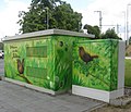
 Ruhland, Bahnhofsvorplatz, Trafostation mit Wandbild, Nordnordwestansicht, 01.jpg 3,648 × 2,736; 2.86 MB
-
 Ruhland, Bahnhofsvorplatz, Trafostation mit Wandbild, Nordnordwestansicht, 02.jpg 3,648 × 2,736; 2.94 MB
-
 Ruhland, Bahnhofsvorplatz, Trafostation mit Wandbild, Nordostansicht, 01.jpg 3,648 × 2,736; 2.82 MB
-
 Ruhland, Bahnhofsvorplatz, Trafostation mit Wandbild, Nordwestansicht, 01.jpg 3,648 × 2,736; 4.82 MB
-
 Ruhland, Bahnhofsvorplatz, Trafostation mit Wandbild, Nordwestansicht, 02.jpg 2,736 × 3,648; 5.09 MB
-
 Ruhland, Bahnhofsvorplatz, Trafostation mit Wandbild, Südsüdostansicht, 01.jpg 3,648 × 2,736; 2.18 MB
-
 Ruhland, Bahnhofsvorplatz, Trafostation mit Wandbild, Südwestansicht, 01.jpg 3,648 × 2,736; 2.51 MB
-
 Ruhland, Bahnhofsvorplatz, Trafostation mit Wandbild, Westansicht, 01.jpg 3,648 × 2,736; 2.5 MB
-
 Ruhland, Bahnhofsvorplatz, Trafostation mit Wandbild, Westnordwestansicht, 01.jpg 2,964 × 2,552; 4.72 MB
-

-
 Ruhland, Brauhausplatz, Stichweg zur Marienstraße.jpg 1,704 × 2,272; 795 KB
-
 Ruhland, Busbahnhof, Ostansicht vom alten Ablaufberg der Bahn 2018, 01.jpg 2,272 × 1,704; 480 KB
-

-

-

-

-

-
 Ruhland, Dresdener Str. 40, Park- und Festplatz Fleischerei Lehmann, 01.jpg 2,272 × 1,704; 469 KB
-

-
 Ruhland, Gartenanlage Hundemeile, Klaus-Reichelt-Platz, Sommer, 01.jpg 3,648 × 2,736; 4.88 MB
-
 Ruhland, Güterbahnhofstr., (alter) Busbahhnhof, Ostansicht 2018.jpg 2,272 × 1,704; 447 KB
-
-
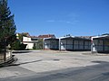
 Ruhland, Güterbahnhofstr., Busplatz, Südostansicht, 01.jpg 2,272 × 1,704; 308 KB
-

-

-

-
 Ruhland, Hartwigstr. nordwärts von Kreuzung Glashüttenstr., Vorfrühling, 01.jpg 2,736 × 3,648; 2.04 MB
-
 Ruhland, Kirchplatz nordwärts mit Lawson-Scheinzypresse an der Südostecke, Frühling, 01.jpg 3,648 × 2,736; 1.38 MB
-
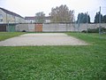 Ruhland, Ortrander Str., Volleyballplatz hinter der Turnhalle, Ostansicht 01.jpg 2,272 × 1,704; 598 KB
,_Nordostansicht,_2018.jpg)


_Busbahhnhof,_Ostansicht_2018.jpg)


