Category:Street signs in the London Borough of Richmond upon Thames
Jump to navigation
Jump to search

Media in category "Street signs in the London Borough of Richmond upon Thames"
The following 33 files are in this category, out of 33 total.
-
 An old street name plate - geograph.org.uk - 2593062.jpg 640 × 475; 46 KB
-
 Atwood's Alley, Kew - geograph.org.uk - 2227582.jpg 1,600 × 1,200; 488 KB
-
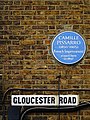 Camille Pissarro - Kew Green Richmond TW9 3BH - Gloucester Road Elevation.jpg 1,500 × 2,000; 1.26 MB
-
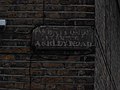
 Ceramic sign on Vernon Road, Mortlake - geograph.org.uk - 4838981.jpg 2,304 × 1,728; 1.39 MB
-
 Ceramic sign on Vernon Road, Mortlake - geograph.org.uk - 4838989.jpg 2,304 × 1,728; 884 KB
-
 Cirrik restaurant - geograph.org.uk - 2540727.jpg 2,048 × 1,536; 578 KB
-
 Corner of Ashburnham Road and Ham Street - geograph.org.uk - 2650332.jpg 1,600 × 1,200; 534 KB
-
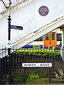
 DSCF0511 Station Road, Percy Road end.jpg 3,072 × 2,304; 1.79 MB
-
 Entrance to Patten Alley, Richmond - geograph.org.uk - 2227532.jpg 1,600 × 1,200; 614 KB
-
 Ferry Lane, Kew - geograph.org.uk - 2407054.jpg 1,024 × 768; 418 KB
-
 Footbridge near South Worple Way, Mortlake - geograph.org.uk - 3304494.jpg 4,288 × 3,216; 5.58 MB
-
 Glasbrook Ave. Borough of Twickenham - geograph.org.uk - 2698344.jpg 1,386 × 1,600; 692 KB
-
 House on Richmond Hill, Surrey - geograph.org.uk - 2042202.jpg 2,592 × 3,872; 2.54 MB
-
 How Do You Pronounce This Street Sign In Richmond - London? (13900520230).jpg 4,000 × 3,000; 2.61 MB
-
 Kew Gardens Road. (7650604770).jpg 2,448 × 2,448; 2.03 MB
-
 Kew-Gardens-Footbridge-Plaque-Context (16917076905).jpg 3,672 × 4,896; 14.09 MB
-
 Looking along Cedars Road - geograph.org.uk - 3670864.jpg 800 × 600; 106 KB
-

-
 Looking east on Arundel Terrace - geograph.org.uk - 3670889.jpg 800 × 600; 184 KB
-
 Looking east on Mill Hill Road - geograph.org.uk - 3670871.jpg 800 × 600; 183 KB
-
 Mortlake Green - geograph.org.uk - 1814404.jpg 480 × 640; 133 KB
-
 North Lane at Broad Street, Teddington, London.jpg 736 × 810; 424 KB
-
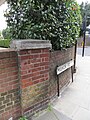
 Old sign for Ashley Road - geograph.org.uk - 3731456.jpg 2,560 × 1,920; 1.68 MB
-
 Priests Bridge SW13. (8362089354).jpg 3,456 × 2,304; 1.96 MB
-
 Road name and pre-Worboys sign - geograph.org.uk - 2277299.jpg 1,600 × 1,200; 557 KB
-
 Road name and pre-Worboys sign - geograph.org.uk - 2277310.jpg 1,600 × 1,200; 563 KB
-
 Sandycombe Road - geograph.org.uk - 1228969.jpg 640 × 480; 76 KB
-
 Ship Lane Passage.jpg 3,321 × 3,156; 1.85 MB
-
-
 The Terrace, and Barnes Bridge.jpg 4,608 × 3,055; 7.3 MB
-
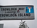 Trowlock Island i.jpg 3,072 × 2,304; 2.73 MB
-
 Holy Trinity Church, Twickenham - London. (6256347665).jpg 3,629 × 2,886; 1.84 MB
-


.jpg)
.jpg)
.jpg)


.jpg)


.jpg)
